Bygland
| Bygland kommune | |||
|---|---|---|---|
| Municipality | |||
 |
|||
|
|||
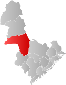
 Bygland within Aust-Agder |
|||
| Coordinates: 58°55′27″N 7°45′53″E / 58.92417°N 7.76472°ECoordinates: 58°55′27″N 7°45′53″E / 58.92417°N 7.76472°E | |||
| Country | Norway | ||
| County | Aust-Agder | ||
| District | Setesdal | ||
| Administrative centre | Bygland | ||
| Government | |||
| • Mayor (1995) | Knut A. Austad (Sp) | ||
| Area | |||
| • Total | 1,312.40 km2 (506.72 sq mi) | ||
| • Land | 1,155.93 km2 (446.31 sq mi) | ||
| • Water | 156.47 km2 (60.41 sq mi) | ||
| Area rank | 70 in Norway | ||
| Population (2010) | |||
| • Total | 1,223 | ||
| • Rank | 384 in Norway | ||
| • Density | 1/km2 (3/sq mi) | ||
| • Change (10 years) | -9.6 % | ||
| Demonym(s) | Byglending | ||
| Time zone | CET (UTC+1) | ||
| • Summer (DST) | CEST (UTC+2) | ||
| ISO 3166 code | NO-0938 | ||
| Official language form | Nynorsk | ||
| Website | www |
||
|
|
|||
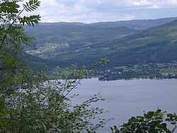
Bygland is a municipality in the county of Aust-Agder, Norway. The municipal centre is the village of Bygland. Other villages in the municipality include Byglandsfjord, Lauvdal, and Åraksbø. The municipality is bordered on the north by Valle, in the east by Fyresdal (Telemark) and Åmli (Aust-Agder), in the south by Froland and Evje og Hornnes, and in the west by Åseral (Vest-Agder), Kvinesdal (Vest-Agder) and Sirdal (Vest-Agder).
Bygland was established as a municipality on 1 January 1838 (see formannskapsdistrikt). Since that time, the municipal boundaries have not changed.
The municipality (originally the parish) is named after the old Bygland farm (Old Norse: Byggland), since the first church was built there. The first element is bygg which means "barley" and the last element is land which means "land" or "farm".
The coat-of-arms is from modern times. They were granted on 15 November 1991. The arms show a European lynx (Lynx lynx), which symbolises the wild and rich nature and forests in the municipality.
Bygland lies in the middle of Setesdal, a valley and a traditional district in Aust-Agder that included the municipalities of Bykle, Valle, Bygland, Iveland, and Evje og Hornnes. The Otra river flows from the glacially scoured Hardanger plateau (Norwegian: Hardangervidda) in Telemark to the north, through the valley of Setesdal (and through Bygland), into the sea near Kristiansand. The lake Gyvatn is located along the border with Evje og Hornnes and Åseral.
...
Wikipedia


