Byesville, Ohio
| Byesville, Ohio | |
|---|---|
| Village | |

West Main Street c. 1910
|
|
| Nickname(s): Bye's Mill | |
 Location of Byesville, Ohio |
|
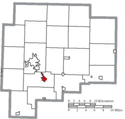
 Location of Byesville in Guernsey County |
|
| Coordinates: 39°58′8″N 81°32′28″W / 39.96889°N 81.54111°WCoordinates: 39°58′8″N 81°32′28″W / 39.96889°N 81.54111°W | |
| Country | United States |
| State | Ohio |
| County | Guernsey |
| Township | Jackson |
| Incorporated | 1882 |
| Established | 1856 |
| Government | |
| • Mayor | Jay Jackson |
| • Founder | Jonathan Bye |
| Area | |
| • Total | 1.19 sq mi (3.08 km2) |
| • Land | 1.19 sq mi (3.08 km2) |
| • Water | 0 sq mi (0 km2) |
| Elevation | 817 ft (249 m) |
| Population (2010) | |
| • Total | 2,438 |
| • Estimate (2012) | 2,420 |
| • Density | 2,048.7/sq mi (791.0/km2) |
| Time zone | Eastern (EST) (UTC-5) |
| • Summer (DST) | EDT (UTC-4) |
| ZIP code | 43723 |
| Area code(s) | 740 |
| FIPS code | 39-10716 |
| GNIS feature ID | 1056747 |
Byesville /ˈbaɪzvɪl/ is a village in Guernsey County, Ohio, United States, along Wills Creek. The population was 2,438 at the 2010 census.
Byesville was platted in 1856, and named for Jonathan Bye, the owner of a mill. The village was incorporated in 1881.
Byesville is located at 39°58′8″N 81°32′28″W / 39.96889°N 81.54111°W (39.968985, -81.541087).
According to the United States Census Bureau, the village has a total area of 1.19 square miles (3.08 km2), all land. Byesville is drained by Wills Creek.
The village is crossed by Interstate 77, Ohio State Route 209, Ohio State Route 821 and Interstate 70, about two miles north of the village.
As of the census of 2010, there were 2,438 people, 1,027 households, and 673 families residing in the village. The population density was 2,048.7 inhabitants per square mile (791.0/km2). There were 1,105 housing units at an average density of 928.6 per square mile (358.5/km2). The racial makeup of the village was 98.2% White, 0.1% African American, 0.2% Native American, 0.2% Asian, and 1.2% from two or more races. Hispanic or Latino of any race were 0.2% of the population.
...
Wikipedia
