Burnhouse
Burnhouse
|
|
|---|---|
 A view of the village looking towards Torranyard and Irvine |
|
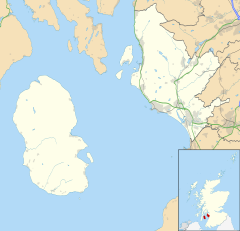
| Burnhouse shown within North Ayrshire | |
| OS grid reference | NS 38431 50338 |
| Council area | |
| Lieutenancy area | |
| Country | Scotland |
| Sovereign state | United Kingdom |
| Dialling code | 01560 |
| Police | Scottish |
| Fire | Scottish |
| Ambulance | Scottish |
| EU Parliament | Scotland |
| UK Parliament | |
| Scottish Parliament | |
Burnhouse, sometimes known locally as The Trap from 'Man Trap' is a small village or hamlet in North Ayrshire, Parish of Beith, Scotland. It lies on a crossroads of old B706 and the more recent A736 Lochlibo Road, between Lugton and Torranyard.
Roy's map of 1747 records the settlement of Burnhouse on the Beith to Kilmarnock road, the Lochlibo Road did not exist at the time. Armstrong's map of 1775 still does not mark the Lochlibo Road as it had not yet been constructed. The 1828 John Thomson's map is the first to show Burnhouse as a crossroads with the newly constructed Lochlibo Road and a Cross Roads Inn. It also shows a 'square' of roads on the west side of the village that are no longer present, although the old ford on the Bungle Burn near the Burnhouse Manor Hotel entrance is still discernible.
The settlement lay within the old Barony of Giffen; the castle no longer exists.
The 'Trap', is short for 'Man Trap' or 'Trap 'Em' because the village lies on the old turnpike road, the busy Lochlibo Road from Irvine to Glasgow via Lugton where dealers, drovers, travellers, etc. on their business or returning from markets in the old days were prone to stop and spend their money at the inns; it was so named by the farmers wives and eventually it was shorted to 'The Trap'. The inn at Lugton was called the 'Lug 'Em Inn', that at Auchentiber the 'Cleek 'Em Inn', and finally the one at Torranyard was called the 'Turn 'Em Out.'
A Crossroads Inn is marked on John Thomson's map of 1828 and in 1858 it had two inns at the crossroads, the Burnhouse Inn and the Waggoners Inn, no longer shown on the 1911 OS.
A Grain Store was once located at Burnhouse, local farmers brought their grain here to be weighed and sold. A Ham Curing business existed here, serving the surrounding farms. A joinery shop here made furniture which had a good reputation for quality. A Police Station was present, complete with a cell and the well next to it was the main source of water for villagers. The village shop was opposite the old inn. A weighing station was located opposite the entrance to Burnhouse Manor Hotel.
Mr. Howatson started a threshing and baling business here in 1928, worked by a traction engine. Howatson was a pioneer of lime spreading machinery.
...
Wikipedia

