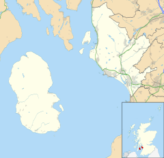
Auchentiber
Auchentiber
|
|
|---|---|
| Auchentiber shown within North Ayrshire | |
| OS grid reference | NS365471 |
| Council area | |
| Lieutenancy area | |
| Country | Scotland |
| Sovereign state | United Kingdom |
| Post town | KILWINNING |
| Postcode district | KA13 |
| Dialling code | 01294 |
| Police | Scottish |
| Fire | Scottish |
| Ambulance | Scottish |
| EU Parliament | Scotland |
| UK Parliament | |
| Scottish Parliament | |
The hamlet of Auchentiber (Scottish Gaelic, Achadh an Tiobair) is in North Ayrshire, Parish of Kilwinning, Scotland. Auchentiber is 4 miles (6.4 km) NE of Kilwinning on the Lochlibo Road, 2.2 miles (3.5 km) from the hamlet of Burnhouse and 2.6 miles (4.2 km) from the village of Barrmill. Grid Ref. NS3647. Some new housing has been built, but the settlement is still very much a hamlet. The settlement is on the Lugton Water, which runs into the River Garnock after running through Montgreenan and Eglinton Country Park in Irvine.
Auchentiber lies on the old toll roads from Ayr (15 miles) to Glasgow (17 miles), and Irvine to Glasgow with a junction for Kilwinning and a nearby country road leading to Bloak, Aiket castle, Bonshaw, the Kilbrides and ultimately to Stewarton. The main part of the village is now on a 'cul de sac', however previously lanes, footpaths and fords gave through routes to Fergushill Hall, the Stewarton road and back up to the Glasgow or 'Lochlibo Road' via Bentfauld farm. A lane branches off at Bloak Road Bridge which runs via several farms, past Clonbeith and thence to Irvine via Sevenacres.
Spelt 'Auchintibber' in 1879, Ainslie's map of 1822 marks the site of the settlement with the modern spelling of 'Auchentiber'. The name 'Achertybry' is marked on Pont's map of 1604, and another similar name, Achyntybers' is marked in the Parish of Stewarton as part of the 'Barony of Balgray'. The Stewarton area farms of this name are still extant and Pont states that the 'Achin-Tybers' are the inheritance of the Earls of Cassillis. Armstrong's map of 1775, shows Auchentiber, Wardlaw and Redwells. Bloak is spelt 'Bloate'.
In 1550, Gavin Hamilton of Raploch, Abbot of Kilwinning Abbey granted the lands of 'Auchintiber' and 'Airthmaid' (Auchenmmade) to Gavin of Raploch, at an annual rent of 16 bolls of beir ('beir', 'bere' also 'bear' was the primitive indigenous form of one-sided barley. It gave a good yield on poor soils and its straw, used for thatching, was long and strong), 9 score 18 stones of cheese, and 7 stirks. This continued with Alexander Cunninghame, the commendator of the abbey in 1571 and third son of Alexander, fifth Earl of Glencairn. He was destined to be shot at his own gate on 1 August 1591 by Sir Robert Montgomerie of Skelmorlie, as part of the reprisals linked to the murder of the Earl of Eglinton, a Montgomery, at the Annick Ford on 18 April 1586.
...
Wikipedia

