Bulltofta Airport
|
Malmö Bulltofta Airport Bulltofta flygplats |
|||||||||||
|---|---|---|---|---|---|---|---|---|---|---|---|

Bulltofta Airport in the 1960s.
|
|||||||||||
| Summary | |||||||||||
| Serves | Malmö | ||||||||||
| Closed | December 2, 1972 | ||||||||||
| Coordinates | 55°36′18″N 13°3′35″E / 55.60500°N 13.05972°ECoordinates: 55°36′18″N 13°3′35″E / 55.60500°N 13.05972°E | ||||||||||
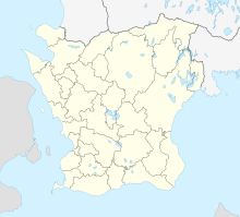
| Map | |||||||||||
| Location within Skåne County | |||||||||||
| Runways | |||||||||||
|
|||||||||||
| Statistics | |||||||||||
|
|||||||||||
| Passengers (1926) | 6,000 |
|---|---|
| Movements (1926) | 2,000 |
| Passengers (1964) | 90,000 |
Malmö Bulltofta Airport (Swedish: Malmö-Bulltofta flygplats; IATA: MMA, ICAO: ESMM) was from 1923 to 1972 the main airport serving the city of Malmö, Sweden. It was replaced by Malmö Sturup Airport. The former airport area, in the former district of Kirseberg, has been converted into, in part, a major park, in part a commercial area.
The route Malmö–Copenhagen, started in 1924, was the world's shortest. During the 1930s, Bulltofta came to be an important European airport, with connections to England, France and the Netherlands. However, the runways were not paved until 1952.
During World War II, the airfield served as the base for the F 10 fighter wing, whose main task was to intercept German and Allied aircraft violating Swedish airspace. Because of the close distance between Malmö and the German coast, Sweden's declared neutrality, and an agreement between the American Bomber Command and the Swedish government, many heavily damaged Allied bomber aircraft came to land at Bulltofta (instead of trying to make the longer trip back to their own airfields in England); these forced landings occurred mostly during the spring and summer of 1944.
...
Wikipedia

