Bryn Mawr, PA
| Bryn Mawr | |
| Census-designated place | |
|
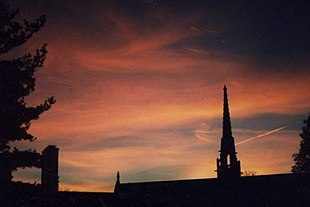
Sunset over Goodhart Hall, Bryn Mawr College
|
|
| Country | United States |
|---|---|
| State | Pennsylvania |
| County | Delaware, Montgomery |
| Township | Radnor, Haverford, Lower Merion |
| Elevation | 420 ft (128.0 m) |
| Coordinates | 40°01′16″N 75°19′01″W / 40.02111°N 75.31694°WCoordinates: 40°01′16″N 75°19′01″W / 40.02111°N 75.31694°W |
| Area | 0.6 sq mi (1.6 km2) |
| - land | 0.6 sq mi (2 km2) |
| - water | 0.0 sq mi (0 km2), 0% |
| Population | 3,779 (2010) |
| Density | 6,298.3/sq mi (2,431.8/km2) |
| Founded | 1681 |
| Timezone | EST (UTC-5) |
| - summer (DST) | EDT (UTC-4) |
| ZIP Code | 19010 |
| Area code | 610 and 484 |
Bryn Mawr (pronounced /ˌbrɪnˈmɑːr/; from Welsh for "great hill") is a census-designated place (CDP) located across Radnor and Haverford Townships in Delaware County, Pennsylvania and Lower Merion Township, Montgomery County, Pennsylvania, just west of Philadelphia along Lancaster Avenue (US-30) and the border with Delaware County. Bryn Mawr is located toward the center of what is known as the Main Line, a group of affluent Philadelphia suburban villages stretching from the city limits to Malvern. As of the 2010 census, it had a population of 3,779. Bryn Mawr is home to Bryn Mawr College.
Bryn Mawr is named after an estate near Dolgellau in Wales that belonged to Rowland Ellis. He was a Quaker who emigrated in 1686 to Pennsylvania from Dolgellau to escape religious persecution.
...
Wikipedia


