Bru, Sogn og Fjordane
| Bru herad | |
|---|---|
| Former Municipality | |

Stavang church in Bru
|
|
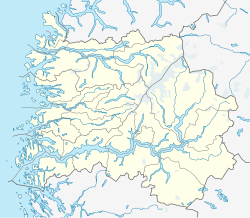
| Location in Sogn og Fjordane county | |
| Coordinates: 61°32′05″N 05°10′56″E / 61.53472°N 5.18222°ECoordinates: 61°32′05″N 05°10′56″E / 61.53472°N 5.18222°E | |
| Country | Norway |
| Region | Western Norway |
| County | Sogn og Fjordane |
| District | Sunnfjord |
| Municipality ID | NO-1436 |
| Admin. Center | Stavang |
| Area | |
| • Total | 382 km2 (147 sq mi) |
| Time zone | CET (UTC+01:00) |
| • Summer (DST) | CEST (UTC+02:00) |
| Split from | Kinn in 1923 |
| Merged into | Flora in 1964 |
Bru is a former municipality in Sogn og Fjordane county, Norway. It is part of the present-day municipality of Flora in the traditional district of Sunnfjord. The administrative center of Bru was the village of Stavang. The municipality existed from 1923 until 1964 and it was made up of parts of the mainland along with several islands including Svanøya, Askrova, and Stavøya. It also included the Solheimsdalen valley, east of the village of Norddalsfjord.
The name of the municipality (and parish) comes from the old name for the island Brulandet (now called Svanøya), where the first church was located. The church site was moved off the island to the mainland village of Stavang in 1872. The Old Norse name for the church was Brúa, which is identical with the word for "bridge".
The parish of Bru was established as a municipality on 1 January 1923 when it was separated from the municipality of Kinn. Bru had an initial population of 1,560 residents. On 1 January 1964, Bru municipality ceased to exist after a municipal merger took place between several neighboring municipalities. The town of Florø, the municipality of Kinn, and parts of the municipalities of Bru (north of the Førdefjorden), Bremanger, and Eikefjord were combined to form the new municipality of Flora. Also, at the same time, the area south of the Førdefjorden, with 92 inhabitants, was transferred to the municipality of Askvoll. Before the merger Bru had a population of 1,247.
...
Wikipedia

