Florø
| Florø ladestad | |
|---|---|
| Former Municipality | |
| Municipality ID | NO-1401 |
| Adm. Center | Florø |
| Created from | Kinn in 1860 |
| Merged into | Flora in 1964 |
|
Florø Flora |
|
|---|---|
| Town | |

View of the town
|
|
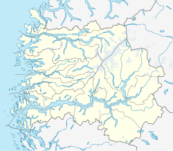
| Location in Sogn og Fjordane county | |
| Coordinates: 61°35′58″N 05°01′58″E / 61.59944°N 5.03278°ECoordinates: 61°35′58″N 05°01′58″E / 61.59944°N 5.03278°E | |
| Country | Norway |
| Region | Western Norway |
| County | Sogn og Fjordane |
| District | Sunnfjord |
| Municipality | Flora |
| Granted City Status | 1860 |
| Town Districts |
List
|
| Area | |
| • Total | 6.05 km2 (2.34 sq mi) |
| Elevation | 5 m (16 ft) |
| Population (2013) | |
| • Total | 8,677 |
| • Density | 1,434/km2 (3,710/sq mi) |
| Time zone | CET (UTC+01:00) |
| • Summer (DST) | CEST (UTC+02:00) |
| Post Code | 6900 Florø |
![]() Florø is a town and the administrative centre of Flora Municipality in Sogn og Fjordane county, Norway. The town was founded by royal decree in 1860 as a ladested (port of lading) on the island of Florelandet, located between the Botnafjorden and Solheimsfjorden. Florø is Norway's (and thus the Scandinavian Peninsula's) westernmost town—west of Amsterdam, Brussels, and Nice. It is the most western town on the mainland in the Nordic countries.
Florø is a town and the administrative centre of Flora Municipality in Sogn og Fjordane county, Norway. The town was founded by royal decree in 1860 as a ladested (port of lading) on the island of Florelandet, located between the Botnafjorden and Solheimsfjorden. Florø is Norway's (and thus the Scandinavian Peninsula's) westernmost town—west of Amsterdam, Brussels, and Nice. It is the most western town on the mainland in the Nordic countries.
The 6.05-square-kilometre (1,490-acre) village has a population (2013) of 8,677; giving the village a population density of 1,434 inhabitants per square kilometre (3,710/sq mi). The town encompasses the entire island of Florelandet and the western half of the island of Brandsøya. The Norwegian National Road 5 highway is the main road connecting Florø to the rest of Norway. The nearby villages of Brandsøy and Grov lie several kilometers to the east of Florø. The islands of Reksta, Kinn, Skorpa lie several kilometers to the west of the town. Florø is also home to Florø Airport and Florø Church.
...
Wikipedia

