Svanøya

View of Svanøy in the 1850s
|
|
|
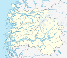
Location in Sogn og Fjordane county
|
|
| Geography | |
|---|---|
| Location | Sogn og Fjordane, Norway |
| Coordinates | 61°29′11″N 5°04′31″E / 61.4865°N 5.0754°ECoordinates: 61°29′11″N 5°04′31″E / 61.4865°N 5.0754°E |
| Length | 10.3 km (6.4 mi) |
| Highest elevation | 235 m (771 ft) |
| Highest point | Vågsfjellet |
| Administration | |
| County | Sogn og Fjordane |
| Municipality | Flora Municipality |
| Demographics | |
| Population | 94 (2001) |
| Pop. density | 9.1 /km2 (23.6 /sq mi) |
Svanøya (also called Svanøyna and Brulandet) is an island in the municipality of Flora in Sogn og Fjordane county, Norway. The island is located in the Sunnfjord district of the county. The island lies just to the west of the mainland, in the mouth of the Førdefjorden. The Brufjorden runs along the north and east sides of the island and the Stavfjorden runs along the south side of the island. The island of Askrova lies about 4 kilometres (2.5 mi) northwest of Svanøya. The 10-square-kilometre (3.9 sq mi) island of Svanøya is heavily forested with lots of hills and small mountains. On Svanøya, there are plants and trees that usually are not found on the west coast of Norway, such as holly. The 235-metre (771 ft) tall mountain Vågsfjellet is the highest mountain on the island.
A stone cross was erected on the island in honor of St. Olaf and there is a sacrificial place from the Viking Age. The Viking, Eirik Bloodaxe, was born on the island. The island was historically called Brulandet, and it is now called Svanøya. The name comes from the Bishop Hans Svane who owned the main farm and manor on the island from 1662—1685. Since that time, it has been known as Svanøya (lit. "the island of Svane"), although Brulandet is still one of the official names of the island. Bru Church was located on the island from the 12th century until the 1872, serving the Bru parish (named after the old name for the island). In 1872, the church was torn down and the new Stavang Church was built on the mainland to serve the parish.
...
Wikipedia

