Brown Clee Hill
| Brown Clee Hill | |
|---|---|

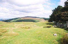
Brown Clee Hill, looking towards Abdon Burf
|
|
| Highest point | |
| Elevation | 540 m (1,770 ft) |
| Prominence | 373 m (1,224 ft) |
| Parent peak | Plynlimon |
| Listing | Marilyn, County Top |
| Coordinates | 52°28′30″N 2°36′02″W / 52.4749°N 2.60063°WCoordinates: 52°28′30″N 2°36′02″W / 52.4749°N 2.60063°W |
| Geography | |
| Location | Shropshire, England |
| OS grid | SO593865 |
| Topo map | OS Landranger 138 |
Brown Clee Hill is the highest hill in the rural English county of Shropshire, at 540 metres (1,770 ft) above sea level. It is one of the Clee Hills, and is in the Shropshire Hills Area of Outstanding Natural Beauty.
Brown Clee Hill lies five miles north of its sister and neighbour, Titterstone Clee Hill. The highest peak of the hill is Abdon Burf, at 540 metres high with Clee Burf at 510m.
Much more of Brown Clee Hill is private land than on Titterstone Clee, and large areas are covered with coniferous plantations. The eastern expanse of the hill is in possession of the Burwarton Estate under ownership of Viscount Boyne, whilst the western fringes of the hill are owned by various private land owners and the parish of Clee St. Margaret.
The common land features the remains of where an Iron Age hill fort once stood (See Below).
Nearby towns are Ludlow, Cleobury Mortimer, Church Stretton, Broseley, Bridgnorth and Much Wenlock.
Several air traffic control radar masts on the summit of the hill can be seen for many miles around. They, along with the ones on top of Titterstone Clee Hill build up a picture of all the aircraft in a hundred-mile radius.
A toposcope (recently built) points out local landmarks and is sited at the summit.
Several hill forts are dotted around the Clee Hills. Nordy Bank is the last intact survivor of three Iron Age hill forts on Brown Clee. The other two, at Abdon Burf and Clee Burf, have been largely lost to quarrying activity. Nordy Bank occupies a sloping ridge top site and its ramparts are up to three metres high. It was built some time in the British Iron Age first Millennium BC and gives a commanding view of the local countryside.
...
Wikipedia

