Broadway (Bronx)

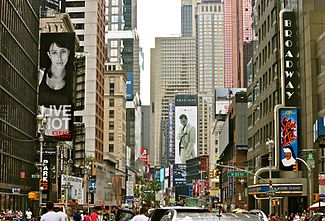
Daytime scene on Broadway
 Broadway through Manhattan, the Bronx and lower Westchester County is highlighted in red |
|
| Length | 33 mi (53 km) |
|---|---|
| Location | New York City (Manhattan and the Bronx) and Westchester County |
| South end | Battery Place in Financial District, Manhattan |
| Major junctions |
|
| North end |
|
Route map: Google
Broadway /ˈbrɔːdweɪ/ is a road in the U.S. state of New York. Broadway runs from State Street at Bowling Green for 13 mi (21 km) through the borough of Manhattan and 2 mi (3.2 km) through the Bronx, exiting north from the city to run an additional 18 mi (29 km) through the municipalities of Yonkers, Hastings-On-Hudson, Dobbs Ferry, Irvington, and Tarrytown, and terminating north of Sleepy Hollow in Westchester County.
It is the oldest north–south main thoroughfare in New York City, dating to the first New Amsterdam settlement, although most of it did not bear its current name until the late 19th century. The name Broadway is the English language literal translation of the Dutch name, , and is also a very common placename element in most English towns where it is used for the principal market street.
...
Wikipedia
