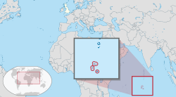
British Indian Ocean Territory
|
British Indian Ocean Territory |
|||||
|---|---|---|---|---|---|
|
|||||
|
Anthem: "God Save the Queen"
|
|||||
 |
|||||
| Status | British Overseas Territory | ||||
| Capital | Camp Justice | ||||
| Largest settlement |
Camp Justice 7°18′S 72°24′E / 7.300°S 72.400°ECoordinates: 7°18′S 72°24′E / 7.300°S 72.400°E |
||||
| Official languages | English | ||||
| Ethnic groups (2001) |
|
||||
| Government | Dependency under a constitutional monarchy | ||||
|
• Monarch
|
Elizabeth II | ||||
| Peter Hayes | |||||
|
• Administrator
|
Tom Moody | ||||
|
• Responsible Ministera (UK)
|
Alok Sharma MP | ||||
| Established in 1965 | |||||
| Area | |||||
|
• Total
|
54,400 km2 (21,000 sq mi) | ||||
|
• Water (%)
|
99.89 | ||||
|
• Land
|
60 km2 23 sq mi |
||||
| Population | |||||
|
• 2012 estimate
|
c.2,500 | ||||
|
• Density
|
58.3/km2 (151.0/sq mi) | ||||
| Currency |
|
||||
| Time zone | (UTC+6) | ||||
| Drives on the | right | ||||
| Calling code | +246 | ||||
| ISO 3166 code | IO | ||||
| Internet TLD | .io | ||||
|
|||||
The British Indian Ocean Territory (BIOT) is an overseas territory of the United Kingdom situated in the Indian Ocean halfway between Tanzania and Indonesia. The territory comprises the seven atolls of the Chagos Archipelago with over 1,000 individual islands – many very small – amounting to a total land area of 60 square kilometres (23 sq mi).
The largest and most southerly island is Diego Garcia, 44 km2 (17 sq mi), the site of a joint military facility of the United Kingdom and the United States. Following the eviction of the native population, the Chagossians, in the 1960s and 1970s, the only inhabitants are US and British military personnel and associated contractors, who collectively number around 2,500 (2012 figures). The islands are off-limits to casual tourists, the media, and their former inhabitants.
Mauritius sought to resume control over the Chagos Archipelago which was split from its territory by the UK in 1965 to form the British Indian Ocean Territory. Between 1968 and 1973, the Chagossians, then numbering about 2,000 people, were expelled by the British government to Mauritius and Seychelles to allow the United States to establish a military base on the island. Today, the exiled Chagossians are still trying to return, claiming that the forced expulsion and dispossession was illegal (see depopulation of Diego Garcia).
The British Indian Ocean Territory is one of only two British territories where traffic drives on the right, the other being Gibraltar.
Maldivian mariners knew the Chagos Islands well. In Maldivian lore, they are known as Fōlhavahi or Hollhavai (the latter name in the closer Southern Maldives). According to Southern Maldivian oral tradition, traders and fishermen were occasionally lost at sea and got stranded on one of the islands of the Chagos. Eventually they were rescued and brought back home. However, these islands were judged to be too far away from the Maldives to be settled permanently by them. Thus, for many centuries the Chagos were ignored by their northern neighbours.
...
Wikipedia


