Brisbin, Pennsylvania
| Brisbin, Pennsylvania | |
|---|---|
| Borough | |

Brisbin, Pennsylvania
|
|
 Map showing Brisbin in Clearfield County |
|
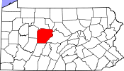
 Map showing Clearfield County in Pennsylvania |
|
| Location in Pennsylvania | |
| Coordinates: 40°50′15″N 78°21′10″W / 40.83750°N 78.35278°WCoordinates: 40°50′15″N 78°21′10″W / 40.83750°N 78.35278°W | |
| Country | United States |
| State | Pennsylvania |
| County | Clearfield |
| Settled | 1854 |
| Incorporated | 1883 |
| Government | |
| • Type | Borough Council |
| Area | |
| • Total | 0.73 sq mi (1.89 km2) |
| • Land | 0.71 sq mi (1.85 km2) |
| • Water | 0.02 sq mi (0.04 km2) |
| Elevation | 1,590 ft (480 m) |
| Population (2010) | |
| • Total | 411 |
| • Density | 575/sq mi (222.2/km2) |
| Time zone | Eastern (EST) (UTC-5) |
| • Summer (DST) | EDT (UTC-4) |
| Zip code | 16620 |
| Area code(s) | 814 |
Brisbin is a borough in Clearfield County, Pennsylvania, United States. The population was 411 at the 2010 census.
Brisbin is located in southeastern Clearfield County at 40°50′15″N 78°21′10″W / 40.837600°N 78.352704°W. It is nearly surrounded by Woodward Township, though Decatur Township partially borders it on the east. The borough of Houtzdale is directly to the south.
According to the United States Census Bureau, the borough has a total area of 0.73 square miles (1.89 km2), of which 0.71 square miles (1.85 km2) is land and 0.02 square miles (0.04 km2), or 1.98%, is water. Gose Run flows through the borough, leading east to Beaver Run, which in turn flows east to Moshannon Creek, a tributary of the West Branch Susquehanna River.
As of the census of 2000, there were 413 people, 166 households, and 124 families residing in the borough. The population density was 655.2 people per square mile (253.1/km2). There were 181 housing units at an average density of 287.1 per square mile (110.9/km2). The racial makeup of the borough was 98.79% White, 0.24% African American, 0.24% from other races, and 0.73% from two or more races. Hispanic or Latino of any race were 0.24% of the population.
...
Wikipedia

