Houtzdale, Pennsylvania
| Houtzdale, Pennsylvania | |
|---|---|
| Borough | |

Houtzdale, Pennsylvania
|
|
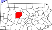
 Map showing Houtzdale in Clearfield County |
|
 Map showing Clearfield County in Pennsylvania |
|
| Pennsylvania | |
| Coordinates: 40°49′34″N 78°21′06″W / 40.82611°N 78.35167°WCoordinates: 40°49′34″N 78°21′06″W / 40.82611°N 78.35167°W | |
| Country | United States |
| State | Pennsylvania |
| County | Clearfield |
| Settled | 1870 |
| Incorporated | March 20, 1872 (Borough) |
| Government | |
| • Type | Borough Council |
| Area | |
| • Total | 0.38 sq mi (0.99 km2) |
| • Land | 0.38 sq mi (0.99 km2) |
| • Water | 0.0 sq mi (0.0 km2) |
| Elevation | 1,530 ft (470 m) |
| Population (2010) | |
| • Total | 797 |
| • Density | 2,082/sq mi (803.7/km2) |
| Time zone | Eastern (EST) (UTC-5) |
| • Summer (DST) | EDT (UTC-4) |
| ZIP code | 16651 |
| Area code(s) | 814 Exchange: 378 |
Houtzdale is a borough in Clearfield County, Pennsylvania, United States. The population was 797 at the 2010 census.
Houtzdale is named after Dr. Daniel Houtz, the original owner of the town site.
Houtzdale is located in southeastern Clearfield County at 40°49′34″N 78°21′6″W / 40.82611°N 78.35167°W (40.825984, -78.351663). It is bordered to the north by the borough of Brisbin. Pennsylvania Route 53 passes through Houtzdale, leading east 5 miles (8 km) to Osceola Mills and west 9 miles (14 km) to Glen Hope. Pennsylvania Route 153 leads north from Houtzdale 17 miles (27 km) to Clearfield, the county seat, and south via PA 453 18 miles (29 km) to Tyrone.
According to the United States Census Bureau, Houtzdale has a total area of 0.38 square miles (0.99 km2), all of it land.
As of the census of 2000, there were 941 people, 380 households, and 275 families residing in the borough. The population density was 2,682.2 people per square mile (1,038.1/km²). There were 432 housing units at an average density of 1,231.4 per square mile (476.6/km²). The racial makeup of the borough was 99.57% White, 0.21% Native American, and 0.21% from two or more races.
...
Wikipedia

