Bregenz Forest Mountains
| Bregenz Forest Mountains | |
|---|---|

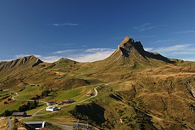
Damülser Mittagsspitze, 2,095 m (6,873 ft)
|
|
| Highest point | |
| Peak | Glatthorn |
| Elevation | 2,134 m (7,001 ft) |
| Geography | |

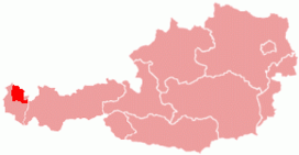
Bregenzerwald region within Austria
|
|
| Country | Austria |
| State | Vorarlberg |
| Range coordinates | 47°15′55″N 9°52′47″E / 47.26528°N 9.87972°ECoordinates: 47°15′55″N 9°52′47″E / 47.26528°N 9.87972°E |
| Parent range |
Northern Limestone Alps Bavarian Alps |
The Bregenz Forest Mountains, also the Bregenzerwald Mountains (German: Bregenzerwaldgebirge), are a range of the Northern Limestone Alps, named after the town of Bregenz. The Bregenz Forest Mountains are entirely located in the Austrian state of Vorarlberg.
The term Bregenz Forest Mountains refers to the range according to the Alpine Club classification of the Eastern Alps (AVE); the term Bregenz Forest, by contrast, refers to a landscape or region which is part of the Bregenzer Ache basin area. As a result, the Bregenz Forest Mountains and the Bregenz Forest are not conterminous.
The Bregenz Forest region also includes the southwestern parts of the Allgäu Alps. On the other hand, the Bregenz Forest Mountains reach, to an extent, into the landscapes of the eastern Rhine Valley, as well as to the Walgau Valley of the Ill River and the Großes Walsertal in the south.
As the range is not geologically uniform, the name is rarely used outside of Alpine literature, is also not used in Vorarlberg state geography and land-use planning and belongs to one of the most disputed mountain groups in the AVE. According to an alternative orographically and hydrologically-oriented mountain range classification (Hubert Trimmel, 1962), the mountains belong to a Rhine Valley–Walgau–Bregenz Forest group.
The mountain range is part of a landscape arranged in several tiers rising from the Rhine Valley in the west up to the adjacent Lechquellen Mountains. Most of the area is shaped by a Mittelgebirge character with extended forests and Alpine pastures, except for small High Alpine region in the southeast.
...
Wikipedia
