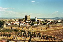
Bragança, Portugal
| Bragança | |||
|---|---|---|---|
| Municipality | |||
 |
|||
|
|||
 |
|||
| Coordinates: 41°48′24″N 6°45′32″W / 41.80667°N 6.75889°WCoordinates: 41°48′24″N 6°45′32″W / 41.80667°N 6.75889°W | |||
| Country |
|
||
| Region | Norte | ||
| Subregion | Alto Trás-os-Montes | ||
| Intermunic. comm. | Terras de Trás-os-Montes | ||
| District | Bragança | ||
| Parishes | 39, see text | ||
| Government | |||
| • President | Hernani Dias (PPD-PSD) | ||
| Area | |||
| • Total | 1,173.57 km2 (453.12 sq mi) | ||
| Elevation | 674 m (2,211 ft) | ||
| Population (2011) | |||
| • Total | 35,341 | ||
| • Density | 30/km2 (78/sq mi) | ||
| Time zone | WET/WEST (UTC+0/+1) | ||
| Postal code | 5300 | ||
| Area code | 273 | ||
| Patron | Nossa Senhora das Graças | ||
| Website | http://www.cm-braganca.pt | ||
Bragança (Portuguese pronunciation: [bɾɐˈɣɐ̃sɐ], Mirandese: Bergáncia, English: Braganza) is a city and municipality in north-eastern Portugal, capital of the district of Bragança, in the Alto Trás-os-Montes subregion of Portugal. The population in 2011 was 35,341, in an area of 1173.57 km².
Archeological evidence permits a determination of human settlement in this region to the Paleolithic. During the Neolithic there was a growth of productive human settlements which concentrated on planting and domestication of animals, with the beginnings of a nascent religion. There are many vestiges of these ancient communities, including ceramics, agricultural implements, weights, arrowheads and modest jewelry, all forged from rock. Many of these artefacts were found in funerary mounds, such as the tumulus of Donai (mostly destroyed). There are many signs of megalthic constructions dotted throughout the region. It is believed that the larger proto-historic communities developed in Terra Fria, probably in the final part of the Bronze Age (1000-700 BC). During this period, the Castro culture of fortified urban structures resulted in walled settlements, situated in elevated areas with a panoramic view, for defense. These communities were essentially survived on subsistence agriculture.
Roman colonization, which occurred late in the Roman era, resulted in the establishment of private property and movement away from the forests, in addition to organizational changes resulting administrative, material and cultural evolution. Remnants of the Luso-Roman castro societies are evident in Castro of Sacóias and the Castro of Avelãs. In these excavations, modern archaeologists have discovered funerary remains, coins and implements. The Castro of Avelãs (about three kilometres from Bragança) was an important centre on the military road to Astorga, although there are many examples (in Alfaião, Aveleda, Carrazedo, Castro de Avelãs, Donai, França, Gostei, Meixedo, Pinela, Quintela Lampaças, etc.) of the Roman presence. The area was dominated by two ethnic communities: the Zoelae, with their seat in Castro de Avelãs, and a Lusitanian civitas under the stewardship of the Baniense in the southern part of the district. A Latin map, Atlas de Gotha by Justus Perthes, mentioned three settlements within this region: Aquae Flaviae (Chaves), Veniatia (Vinhais) and Zoelae (its seat in Zoelas, today Castro de Avelãs) without mentioning any reference to a name similar to Bragança. During Roman colonization, it was part of Gallaecia and dependent administratively on Astorga, on the Atlantic axis of a Roman highway from Meseta, that controlled the gold, iron and silver trade. The references to a settlement with the name similar to Bragança occurred in the acts of Council Lugo (569 AD) regarding the Vergancia. A similar reference by Wamba (666 AD) referred to Bregancia, and where, supposedly two Christian martyrs (John and Paul) were born.
...
Wikipedia


