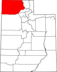
Box Elder County, Utah
| Box Elder County, Utah | |
|---|---|

Box Elder County Courthouse
|
|
 Location in the U.S. state of Utah |
|
 Utah's location in the U.S. |
|
| Founded | 1856 |
| Named for | Box elder tree |
| Seat | Brigham City |
| Largest city | Brigham City |
| Area | |
| • Total | 6,729 sq mi (17,428 km2) |
| • Land | 5,746 sq mi (14,882 km2) |
| • Water | 934 sq mi (2,419 km2), 15% |
| Population | |
| • (2010) | 49,975 |
| • Density | 8.7/sq mi (3/km²) |
| Congressional district | 1st |
| Time zone | Mountain: UTC-7/-6 |
| Website | www |
Box Elder County is a county in the U.S. state of Utah. As of the 2010 Census, the population was 49,975. Its county seat and largest city is Brigham City. The county was named for the box elder trees that abound in the county.
Box Elder County lies on the north end of the Great Salt Lake, covering a large area north to the Idaho border and west to the Nevada border. Included in this area are large tracts of barren desert, contrasted by high, forested mountains. The Wasatch Front lies along the south-eastern border, where the main cities are found.
Box Elder County is part of the Ogden-Clearfield, UT Metropolitan Statistical Area, which is also included in the Salt Lake City-Provo-Orem, UT Combined Statistical Area.
The California Trail followed Goose Creek from a point just north of the Idaho/Utah border southwest across northwestern Box Elder County to Little Goose Creek in northeastern Elko County, Nevada. The link-up of the first transcontinental railroad at Promontory Summit, Utah.
The famous Spiral Jetty was built in 1970.
According to the U.S. Census Bureau, the county has a total area of 6,729 square miles (17,430 km2), of which 5,746 square miles (14,880 km2) is land and 984 square miles (2,550 km2) (15%) is water. It is the fourth-largest county in Utah by area.
...
Wikipedia
