Bougie
|
Béjaïa Bgayet, ⴱⴳⴰⵢⴻⵜ (Kabyle) |
|
|---|---|
| City | |
 |
|
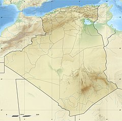
 Location of Béjaïa, Algeria within Béjaïa Province |
|
| Location of Béjaïa, Algeria within Béjaïa Province | |
| Coordinates: 36°45′N 5°04′E / 36.750°N 5.067°ECoordinates: 36°45′N 5°04′E / 36.750°N 5.067°E | |
| Country |
|
| Province | Béjaïa Province |
| District | Béjaïa District |
| Area | |
| • Total | 120.22 km2 (46.42 sq mi) |
| Elevation | 949 m (3,114 ft) |
| Population (2008 census) | |
| • Total | 177,988 |
| • Density | 1,500/km2 (3,800/sq mi) |
| Time zone | CET (UTC+1) |
| Postal code | 06000 |
| Climate | Csa |

Cap Carbon Lighthouse in 2013
|
|
|
Algeria
|
|
| Location | Cap Carbonbr Béjaïa |
|---|---|
| Coordinates | 36°46′34.25″N 5°6′14.83″E / 36.7761806°N 5.1041194°E |
| Year first constructed | 1906 |
| Construction | masonry tower |
| Tower shape | cylindrical tower with balcony and lantern rising from the keeper’s house |
| Markings / pattern | white tower, black lantern roof |
| Height | 14.60 metres (47.9 ft) |
| Focal height | 224.10 metres (735.2 ft) |
| Range | 29 nautical miles (54 km; 33 mi) |
| Characteristic | Fl (3) W 20s. |
| Admiralty number | E6572 |
| NGA number | 22328 |
| ARLHS number | ALG-007 |
| Managing agent | Office Nationale de Signalisation Maritime |
Béjaïa (Kabyle: Bgayet, ⴱⴳⴰⵢⴻⵜ), formerly Bougie and Bugia, is a Mediterranean port city on the Gulf of Béjaïa in Algeria; it is the capital of Béjaïa Province, Kabylia. Béjaïa is the largest principally Kabyle-speaking city in the Kabylie region of Algeria. The history of Béjaïa explains the diversity of the local population. Its inhabitants are mainly Berbers.
The town is overlooked by the mountain Yemma Gouraya, whose profile is said to resemble a sleeping woman; other nearby scenic spots include the Aiguades beach and the Pic des Singes (Monkey Peak); the latter site is a habitat for the endangered Barbary macaque, which prehistorically had a much broader distribution than at present. All three of these geographic features are contained in the Gouraya National Park. The Soummam river runs past the town.
Under French rule, it was formerly known under various European names, such as Budschaja in German, Bugia in Italian, and Bougie [buˈʒi] (the latter two being words for candle, derived from the town name because of its wax trade).
Béjaïa stands on the site of the ancient city of Saldae, a minor port in Carthaginian and Roman times in an area at first inhabited by Numidian Berbers and founded as a veteran colony by emperor Augustus. It was an important town and a bishopric in the province of Mauretania Caesariensis, and the later Sitifensis.
...
Wikipedia


