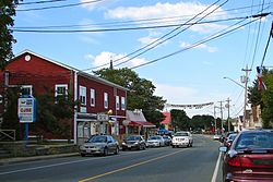
Bouctouche, New Brunswick
|
Bouctouche Chebooktoosk |
||
|---|---|---|
| Town | ||
 |
||
|
||
| Nickname(s): Great Little Harbour | ||
| Location within New Brunswick | ||
| Coordinates: 46°28′19″N 64°43′30″W / 46.4719°N 64.7249°WCoordinates: 46°28′19″N 64°43′30″W / 46.4719°N 64.7249°W | ||
| Country | Canada | |
| Province | New Brunswick | |
| County | Kent County | |
| Parish | Richibucto Parish | |
| Founded | June 24, 1785 | |
| Incorporated | July 24, 1985 | |
| Government | ||
| • Mayor | Roland Fougère | |
| • Governing Body | Bouctouche Town Council | |
| Area | ||
| • Total | 18.34 km2 (7.08 sq mi) | |
| Highest elevation | 23 m (75 ft) | |
| Lowest elevation | 0 m (0 ft) | |
| Population (2011) | ||
| • Total | 2,423 | |
| • Density | 132.1/km2 (342/sq mi) | |
| Time zone | AST (UTC−4) | |
| • Summer (DST) | ADT (UTC−3) | |
| Canadian Postal code | E4S | |
| Area code(s) | 506 | |
| Telephone Exchanges | 291 341 743 744 955 | |
| Highway | Route 11 | |
| Waterway | Bouctouche Harbour | |
| NTS Map | 021I07 | |
| GNBC Code | DBBXR | |
| Website | www |
|
|
New Brunswick
|
|
| Location | Bouctouche New Brunswick Canada |
|---|---|
| Coordinates | 46°27′40.15″N 64°36′46.35″W / 46.4611528°N 64.6128750°W |
| Year first constructed | 1902 (first) |
| Year first lit | n/a (current) |
| Foundation | concrete basement (current) |
| Construction | wooden tower (both) |
| Tower shape | square frustum tower with balcony and lantern (current) square prism tower atop keeper’s house (first) |
| Markings / pattern | white tower and lantern, red lantern roof (current) |
| Height | 8 metres (26 ft) (current) 10.6 metres (35 ft) (first) |
| Focal height | 11 metres (36 ft) (current) 11.5 metres (38 ft) (first) |
| Light source | solar power |
| Range | 7 nautical miles (13 km; 8.1 mi) |
| Characteristic | Fl W 4s. |
| Admiralty number | H1362 |
| CHS number | CCG 1122 |
| NGA number | 7680 |
| ARLHS number | CAN-055 |
| Managing agent | private |
Bouctouche /ˈbʌktuːʃ/ is a Canadian town in Kent County, New Brunswick. In 2011, the population was 2,423.
Bouctouche was originally named Tjipogtotjg (pronounced Chebooktoosk), a Mi'kmaq word meaning "Great Little Harbour". The region was next settled by brothers Francois LeBlanc and Charles LeBlanc, and brothers Isidore Bastarache and Joseph Bastarache in 1785 as an Acadian community. “La Croix commémorative aux fondateurs de Bouctouche” was unveiled August 29, 1954, to pay tribute to the founders of the town, who first arrived in 1785. It says “We remember François and Hélène (née Breau) LeBlanc; Charlitte and first wife Marie (née Breau) LeBlanc, and his second wife Madeleine (née Girouard); and Joseph and Marie (née Girouard) Bastarache”. The stones at the base of the cross indicate the origins of the settlers who came from France, Grand-Pré, Memramcook and Bouctouche. During the 19th century the area also attracted immigrants from Ireland and Scotland among them the forefathers of one of Bouctouche’s best-known sons, K.C. Irving. Bouctouche was struck by a tornado on August 6, 1879.
The town is located at the mouth of the Bouctouche River on the coast of the Northumberland Strait, approximately 40 kilometres northeast of Moncton.
It is the first municipality in New Brunswick to adopt a Green Plan for the working of the municipality in 2006.
...
Wikipedia


