Bosilegrad
|
Босилеград Bosilegrad |
||
|---|---|---|
| Town and municipality | ||

Panoramic view of Bosilegrad
|
||
|
||
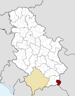
 Location of the municipality of Bosilegrad within Serbia |
||
| Coordinates: 42°30′N 22°28′E / 42.500°N 22.467°ECoordinates: 42°30′N 22°28′E / 42.500°N 22.467°E | ||
| Country |
|
|
| Region | Southern and Eastern Serbia | |
| District | Pčinja | |
| Settlements | 37 | |
| Government | ||
| • Mayor | Vladimir Zaharijev (DSS) | |
| Area | ||
| • Municipality | 571 km2 (220 sq mi) | |
| Elevation | 696 m (2,283 ft) | |
| Population (2011 census) | ||
| • Town | 2,624 | |
| • Municipality | 8,129 | |
| Time zone | CET (UTC+1) | |
| • Summer (DST) | CEST (UTC+2) | |
| Postal code | 17540 | |
| Area code | +381(0)17 | |
| Car plates | VR | |
| Website | www |
|
Bosilegrad (Serbian Cyrillic: Босилеград) is a town and municipality located in the Pčinja District of the southern Serbia. The municipality comprises an area of 571 km². According to 2011 census, it has a total population of 8,129 inhabitants, while the town has 2,624.
The majority of municipality's population are Bulgarians, amounting to over 70% of total population. Other minor ethnic groups are Serbs and Roma people. Only 32.28% inhabitants live in urban areas. The ethnic composition of the municipality:
Historically a Bulgarian land, The Kingdom of Serbs, Croats and Slovenes gained some territory from Bulgaria as part of the Treaty of Neuilly-sur-Seine, following the invasion and occupation of part of the Kingdom of Serbia by Bulgaria and subsequent Allied defeat of the Central Powers in the First World War. The Bulgarian army occupied Bosilegrad again between 1941-1944.
Bosilegrad flag
Map of the Bosilegrad municipality
Unveiling of the monument of Bulgarian revolutionary Vasil Levski in Bosilegrad.
...
Wikipedia

