Borznianskyi Raion
|
Borznianskyi Raion Борзнянський район |
|||
|---|---|---|---|
| Raion | |||
|
|||
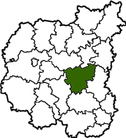
 Raion location in Chernihiv Oblast |
|||
| Coordinates: 51°14′59″N 32°22′2″E / 51.24972°N 32.36722°ECoordinates: 51°14′59″N 32°22′2″E / 51.24972°N 32.36722°E | |||
| Country | Ukraine | ||
| Oblast | Chernihiv Oblast | ||
| Admin. center | Borzna | ||
| Area | |||
| • Total | 1,600 km2 (600 sq mi) | ||
| Population (2015) | |||
| • Total | 32,440 | ||
| • Density | 20/km2 (53/sq mi) | ||
| Time zone | EET (UTC+2) | ||
| • Summer (DST) | EEST (UTC+3) | ||
| Website | borzadm |
||
Borznianskyi Raion (Ukrainian: Борзнянський район) is a raion (district) of Chernihiv Oblast, northern Ukraine. Its administrative centre is located at the town of Borzna. Population: 32,440 (2015 est.)
Borznianskyi Raion was founded in 1923. Its area makes up 5% of the oblast territory. The region is situated almost at the center of the oblast and borders on Menskyi Raion, Sosnytskyi Raion, Koropskyi Raion, Bakhmatskyi Raion, Ichnianskyi Raion, Nizhynskyi Raion and Kulykivskyi Raion.
The raion covers an area of 1,600 square kilometres.
There are 63 built-up areas in the region, which are subordinated by the town council and by the 26 village councils.
The landscape of the territory is mainly plain, the northern part is somewhat waterlogged, with woods (pine-trees, alder-trees, oaks, aspen-trees), small rivers and lakes. The biggest river is Desna with Seym and Borzenka inflows.
The soil is mainly chernozem, meadow-chernozem, ash-laden and sod-ash-laden. The region is located on the south border of the mixed forest zone. Among minerals there are peat, industrial supply of clay and sand.
The region is intersected by the international highway Moscow—Kiev (European route E101); the railways are going in two directions, the biggest stations for freight transport and passenger traffic are Doch, Plysky and Kruty.
...
Wikipedia


