Bondo, Switzerland
| Bondo | ||
|---|---|---|
| Former municipality of Switzerland | ||
|
||
| Coordinates: 46°20′N 9°33′E / 46.333°N 9.550°ECoordinates: 46°20′N 9°33′E / 46.333°N 9.550°E | ||
| Country | Switzerland | |
| Canton | Graubünden | |
| District | Maloja | |
| Government | ||
| • Mayor | Renzo Giovanoli | |
| Area | ||
| • Total | 26.26 km2 (10.14 sq mi) | |
| Elevation | 823 m (2,700 ft) | |
| Population | ||
| • Total | 204 | |
| • Density | 7.8/km2 (20/sq mi) | |
| Postal code | 7606 | |
| Surrounded by | Castasegna, Novate Mezzola (IT-SO), Soglio, Stampa, Val Masino (IT-SO), Vicosoprano, Villa di Chiavenna (IT-SO) | |
| Website |
www |
|
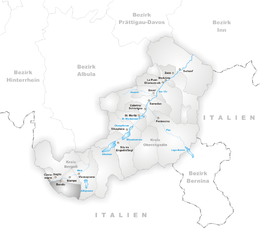
Bondo (Romansh: ![]() Buond ) is a former municipality in the district of Maloja in the Swiss canton of Grisons. It is now part of the municipality of Bregaglia.
Buond ) is a former municipality in the district of Maloja in the Swiss canton of Grisons. It is now part of the municipality of Bregaglia.
The municipality is located near the Swiss–Italian border south of the Mera River in the Val Bregaglia (known as Bergell in German). It is located in the Bergell sub-district of the Maloja district. The valley floor is so deep that parts of the village do not receive any sunlight in winter. The Val Bondasca leads up from Bondo to Piz Badile and Piz Cengalo, two peaks of the Bregaglia Range.
The municipality of Bondo also includes the smaller village of Promontogno and, above that on a rocky outcrop, the ruins of Castelmur fort. Additionally there are several abandoned settlements.
Bondo has an area, as of 2006[update], of 28.2 km2 (10.9 sq mi). Of this area, 2.5% is used for agricultural purposes, while 37.6% is forested. Of the rest of the land, 0.6% is settled (buildings or roads) and the remainder (59.3%) is non-productive (rivers, glaciers or mountains).
...
Wikipedia


