Bolecica
| Bolečica (Болечица) | |
|---|---|

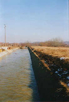
Bolečica in the early 2000s, before the expansion of the Leštane industrial zone
|
|
| Country | Serbia |
| Basin features | |
| Main source | south of Vrčin, Serbia 105 m (344 ft) |
| River mouth | Danube, at Vinča, Serbia |
| Physical characteristics | |
| Length | 12 km (7.5 mi) |
The Bolečica (Serbian Cyrillic: Болечица) is a short river in north-central Serbia, a 12 km-long right tributary to the Danube. During its entire flow it runs through the suburban section of Belgrade and despite being short it flows through the three Belgrade's municipalities, next to the half dozen of suburbs of Belgrade (giving its name to one of them) with a total population of 35,000 and is a route to important roads.
Bolečica originates in the northern, low Šumadija region, between two "Belgrade mountains", Avala and Kosmaj, on the slopes of the Begaljica Hill, at an altitude of 105 meters. Originally, it flows to the north along the eastern slopes of the Avala, crossing between the municipalities of Grocka and Voždovac, next to the villages of Vrčin and Zuce, where it receives the Vranovac creek from the right and enters the valley of Bubanj Potok where it marks the eastern border of the woods of Stepin Lug, turns to the north-east through the southernmost tip of the municipality of Zvezdara (for some 300 meters) and receives two more creeks from the left, Bubanj Potok and Zavojnička reka. Bolečica continues through the southern section of Leštane, where it receives the creek of Kaluđerički potok from the left and forms the border between the four suburbs area: Leštane, Boleč, Ritopek and Vinča (where it receives the creek of Makački potok from the left), where it empties into the Danube by a small estuary at an altitude of 68 meters, just east of Belo Brdo, the archeological find of the Vinča culture.
...
Wikipedia
