Bluffton, South Carolina
| Bluffton, South Carolina | ||
|---|---|---|
| Town | ||

Clockwise from top: the May River, the Heyward House, a gravel path, CareCore Dr, a Post Office, Myrtle Island, and The Store
|
||
|
||
| Motto: A State of Mind | ||
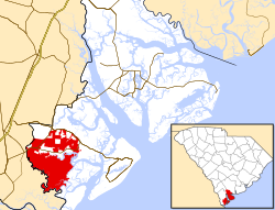
 Location in Beaufort County and South Carolina |
||
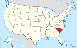
 Location of South Carolina in the United States |
||
| Coordinates: 32°12′45″N 80°53′50″W / 32.21250°N 80.89722°WCoordinates: 32°12′45″N 80°53′50″W / 32.21250°N 80.89722°W | ||
| Country | United States | |
| State | South Carolina | |
| Counties | Beaufort | |
| Settled | 1728 | |
| Founded | 1852 | |
| Government | ||
| • Type | Town council | |
| • Mayor | Lisa Sulka | |
| • Town council |
Members
|
|
| Area | ||
| • Total | 54 sq mi (141 km2) | |
| • Land | 52.2 sq mi (135.3 km2) | |
| • Water | 2.2 sq mi (5.7 km2) | |
| Elevation | 20 ft (6 m) | |
| Population (2010) | ||
| • Total | 12,893 | |
| • Density | 251/sq mi (97.0/km2) | |
| Time zone | EST (UTC-5) | |
| • Summer (DST) | EDT (UTC-4) | |
| ZIP codes | 29909-29910 | |
| Area code | 843 | |
| FIPS code | 45-07210 | |
| GNIS feature ID | 1220833 | |
| Website | www |
|
Bluffton is a Lowcountry town in Beaufort County, South Carolina, United States. It is primarily located around U.S. Route 278, between Hilton Head Island and Interstate 95. The town's original one square mile area, now known as Old Town, is situated on a bluff along the May River. The population was counted by the 2010 census at 12,893. Bluffton is the fastest growing municipality in South Carolina with a population over 2,500, growing 882.7% between the 2000 and 2010 census. Bluffton is the fifth largest municipality in South Carolina by land area. The town is a primary city within the Hilton Head Island-Bluffton-Beaufort, SC Metropolitan Statistical Area. Bluffton is known for its eclectic Old Town district and natural views of the May River. It has been called "the last true coastal village of the South."
Following the Tariff of 1842, Bluffton became a hotbed of separatist sentiment. In 1844 the Bluffton Movement, a protest against federal taxes, gave birth to the secession movement and led South Carolina to be the first state to leave the Union. In the antebellum period Bluffton became a popular location for wealthy merchants and plantation owners. During the Civil War two-thirds of the town was destroyed by fire during the Union's Bluffton Expedition on June 4, 1863.
During the seventeenth and eighteenth centuries, the area comprising southern Beaufort County was known as Granville County of St. Luke's Parish. The Yamasee people were invited to settle in the area by Lord Cardoss, leader of the nearby Scottish settlement in Beaufort. The Yamasee established ten towns with over 1,200 inhabitants in the area. In 1715, the Yamasee War broke out, and after several years of fighting, the Yamasee migrated to Florida, opening the "Indian Lands" to European settlement. In 1718, the Lords Proprietors carved the area into several new baronies, including the Devil's Elbow Barony that contained the future town of Bluffton. The first titled owner of the land was the Barbadian planter Sir John Colleton. Following the departure of the Yamasee people, colonists began building plantations in the Bluffton area in 1728. The Colletons prospered by growing cotton, corn and indigo.
...
Wikipedia

