Bluefield, Virginia
| Town of Bluefield, Virginia | ||
|---|---|---|
| Town | ||
|
||
| Nickname(s): Virginia's Tallest Town | ||
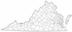
 Location in the Commonwealth of Virginia |
||
| Coordinates: 37°14′39″N 81°16′30″W / 37.24417°N 81.27500°WCoordinates: 37°14′39″N 81°16′30″W / 37.24417°N 81.27500°W | ||
| Country | United States | |
| State | Virginia | |
| County | Tazewell | |
| Incorporated | 1883 | |
| Government | ||
| • Mayor | Don Harris | |
| Area | ||
| • Town | 7.6 sq mi (162.0 km2) | |
| • Land | 7.6 sq mi (162.0 km2) | |
| • Water | 0.0 sq mi (0.0 km2) | |
| Elevation | 2,389 ft (728.167 m) | |
| Population (2010) | ||
| • Town | 5,444 | |
| • Density | 670/sq mi (258.6/km2) | |
| • Metro | 107,342 (Bluefield Micropolitan Area) | |
| Time zone | EST (UTC-5) | |
| • Summer (DST) | EDT (UTC-4) | |
| ZIP code | 24605 | |
| Area code(s) | 276 | |
| FIPS code | 51-08152 | |
| GNIS feature ID | 1481874 | |
| Website | http://www.bluefieldva.org/ | |
Bluefield is a town in Tazewell County, Virginia, along the Bluestone River. The population was 5,444 at the 2010 census. It is part of the Bluefield WV-VA micropolitan area which has a population of 107,342. The micropolitan area is the 350th largest statistical population area in the United States.
Bluefield is located at 37°14′39″N 81°16′30″W / 37.24417°N 81.27500°W (37.244195, -81.274926).
According to the United States Census Bureau, the town has a total area of 7.6 square miles (19.6 km²), all land.
As of the census of 2000, there were 5,078 people, 2,134 households, and 1,423 families residing in the town. The population density was 669.9 people per square mile (258.7/km²). There were 2,349 housing units at an average density of 309.9 per square mile (119.7/km²). The racial makeup of the town was 92.30% White, 4.86% African American, 0.32% Native American, 1.42% Asian, 0.12% from other races, and 0.98% from two or more races. Hispanic or Latino of any race were 0.41% of the population.
...
Wikipedia

