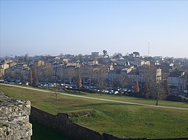
Blaye
| Blaye | ||
|---|---|---|
 |
||
|
||
| Coordinates: 45°07′43″N 0°39′40″W / 45.1286°N 0.6611°WCoordinates: 45°07′43″N 0°39′40″W / 45.1286°N 0.6611°W | ||
| Country | France | |
| Region | Nouvelle-Aquitaine | |
| Department | Gironde | |
| Arrondissement | Blaye | |
| Canton | Blaye | |
| Government | ||
| • Mayor (2008–2014) | Denis Baldès | |
| Area1 | 6.42 km2 (2.48 sq mi) | |
| Population (2008)2 | 4,959 | |
| • Density | 770/km2 (2,000/sq mi) | |
| Time zone | CET (UTC+1) | |
| • Summer (DST) | CEST (UTC+2) | |
| INSEE/Postal code | 33058 /33390 | |
| Elevation | 0–41 m (0–135 ft) (avg. 7 m or 23 ft) |
|
|
1 French Land Register data, which excludes lakes, ponds, glaciers > 1 km² (0.386 sq mi or 247 acres) and river estuaries. 2Population without double counting: residents of multiple communes (e.g., students and military personnel) only counted once. |
||
1 French Land Register data, which excludes lakes, ponds, glaciers > 1 km² (0.386 sq mi or 247 acres) and river estuaries.
Blaye (French pronunciation: [blaj]; Occitan: Blaia pronounced [ˈblajɔ]) is a commune and subprefecture in the Gironde department in Nouvelle-Aquitaine in southwestern France.
Its inhabitants are called Blayais or the Blayaises.
Blaye is located on the right bank of the Gironde estuary (which is some 3 km (1.9 mi) wide at this point), close to the A10 autoroute, 56 km (35 mi) north of Bordeaux. There is a rail line with occasional freight trains, but no passenger services. A small ferry crosses the Gironde to Lamarque, in Medoc.
In ancient times Blaye (Blavia) was a port of the Santones. Tradition states that the Frankish hero Roland was buried in its basilica, which was on the site of the citadel. It was early an important stronghold which played an important part in the wars against the English (who burnt it in 1352) and the French Wars of Religion (when it was the site of a Spanish naval victory in 1593). The duchess of Berry was imprisoned in its fortress in 1832-1833.
...
Wikipedia


