Bland Shire, New South Wales
|
Bland Shire New South Wales |
|||||||||||||||
|---|---|---|---|---|---|---|---|---|---|---|---|---|---|---|---|

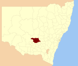
Location in New South Wales
|
|||||||||||||||
| Coordinates | 33°56′S 147°15′E / 33.933°S 147.250°ECoordinates: 33°56′S 147°15′E / 33.933°S 147.250°E | ||||||||||||||
| Population | 5,995 (2016 census) | ||||||||||||||
| • Density | 0.7004/km2 (1.8139/sq mi) | ||||||||||||||
| Area | 8,560 km2 (3,305.0 sq mi) | ||||||||||||||
| Mayor | Tony Lord (Unaligned) | ||||||||||||||
| Council seat | West Wyalong | ||||||||||||||
| Region | Central West | ||||||||||||||
| State electorate(s) | Cootamundra | ||||||||||||||
| Federal Division(s) | |||||||||||||||
 |
|||||||||||||||
| Website | Bland Shire | ||||||||||||||
|
|||||||||||||||
Bland Shire is a local government area in Central West, New South Wales in Australia. it covers an area of 3,305 square miles. As of the 2016 census the population is 5995. It is a twin town of Dull, Perth and Kinross, Scotland and Boring, Oregon, USA.
The council area is named after William Bland.
Bland shire is located on the boundary between the central west and Riverina regions. The area is adjacent to the Newell and Mid-Western highways.
The farm community of Bland Shire, West Wyalong was a former gold prospecting site in the Riverina region of New South Wales, Australia,
The largest town and council seat is West Wyalong. The region also includes the towns of Wyalong, Barmedman, Tallimba, Ungarie, Weethalle and Mirrool. The major economic activities of the shire are agriculture, mining, transport, tourism and wholesale distribution.
In 2013, the community joined Dull in Perthshire, Scotland and Boring in Oregon, USA to create a "League of Extraordinary Communities" to group Dull, Boring and Bland as a means of encouraging travel, promoting all three communities.
...
Wikipedia
