Big Sandy, Texas
| Big Sandy, Texas | |
|---|---|
| Town | |

Big Sandy Lake is cut by U.S. Highway 80 in Big Sandy, Texas
|
|
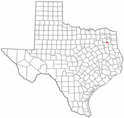
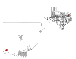
 Location of Big Sandy, Texas |
|
 |
|
| Coordinates: 32°35′5″N 95°6′44″W / 32.58472°N 95.11222°WCoordinates: 32°35′5″N 95°6′44″W / 32.58472°N 95.11222°W | |
| Country | United States |
| State | Texas |
| County | Upshur |
| Area | |
| • Total | 1.7 sq mi (4.3 km2) |
| • Land | 1.6 sq mi (4.2 km2) |
| • Water | 0.0 sq mi (0.1 km2) |
| Elevation | 367 ft (112 m) |
| Population (2010) | |
| • Total | 1,343 |
| • Density | 790/sq mi (310/km2) |
| Time zone | Central (CST) (UTC-6) |
| • Summer (DST) | CDT (UTC-5) |
| ZIP codes | 75755, 75797 |
| Area code(s) | 903 |
| FIPS code | 48-08224 |
| GNIS feature ID | 1330639 |
Big Sandy is a town in Upshur County, Texas, United States. As of the 2010 census, the town's population was 1,343. A lake of the same name is cut nearly in half by U.S. Highway 80, the main thoroughfare of Big Sandy.
The Sabine River flows just south of Big Sandy. In the 19th century, Walters' Bluff Ferry operated on the Sabine, with passage across costing 40 cents per person and up to 75 cents for wagons.
Big Sandy is located at 32°35′5″N 95°6′44″W / 32.58472°N 95.11222°W (32.584693, -95.112297).
According to the United States Census Bureau, the town has a total area of 1.7 square miles (4.3 km²), of which, 1.6 square miles (4.2 km²) of it is land and 0.04 square miles (0.1 km²) of it (1.80%) is water.
As of the census of 2000, there were 1,288 people, 532 households, and 342 families residing in the town. The population density was 786.8 people per square mile (303.2/km²). There were 595 housing units at an average density of 363.4/sq mi (140.1/km²). The racial makeup of the town was 81.75% White, 12.89% African American, 0.39% Native American, 1.16% Asian, 2.95% from other races, and 0.85% from two or more races. Hispanic or Latino of any race were 3.49% of the population.
...
Wikipedia
