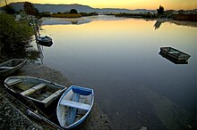
Bidasoa River
| Bidasoa | |
|---|---|

Bidasoa River (in Spain)
|
|
| Country | Spain, France |
| Basin features | |
| Main source | Western Pyrenees |
| River mouth |
Bay of Biscay 43°22′22″N 1°47′31″W / 43.37278°N 1.79194°WCoordinates: 43°22′22″N 1°47′31″W / 43.37278°N 1.79194°W |
| Basin size | 705 km2 (272 sq mi) |
| Physical characteristics | |
| Length | 66 km (41 mi) |
| Discharge |
|
The Bidasoa (Basque: [bidasoa], Spanish: [biðaˈsoa]; French: Bidassoa) is a river in the Basque Country of northern Spain and southern France that runs largely south to north. Named as such downstream of the small town of Oronoz-Mugairi (municipality of Baztan) in the province of Navarre, the river actually results from the merge of several streams near the village Erratzu, with the stream Baztan that rises at the north-eastern side of the mount Autza (1,306 m) being considered the source of the Bidasoa. It joins the Cantabrian Sea (Bay of Biscay) between the towns of Hendaye and Hondarribia.
The river is best known for establishing the borderline at its lower tract. This stretch is crossed not only by aircraft at low height but by important European communication axes, namely AP8 E5 E80 - E70 A63 (motorway, connection at the Biriatu toll), main roads N1 - N10 (connection at the roundabout of Saizar by the river) and major French and Spanish railway networks,—RENFE and SNCF. Besides these major lines, other regional ones cross it too, e.g. regional railway EuskoTren (terminus in Hendaye) and another double bridge (pedestrians/vehicles) joining the towns on the border, i.e. the historical Santiago Bridge (Way of St. James). At this stage of the river, urban landscape prevails (built-up area).
...
Wikipedia
