Bevaix
| Bevaix | ||
|---|---|---|
|
||
| Coordinates: 46°56′N 6°49′E / 46.933°N 6.817°ECoordinates: 46°56′N 6°49′E / 46.933°N 6.817°E | ||
| Country | Switzerland | |
| Canton | Neuchâtel | |
| District | Boudry | |
| Area | ||
| • Total | 10.78 km2 (4.16 sq mi) | |
| Elevation | 475 m (1,558 ft) | |
| Highest elevation (Petite Ecoeurne) | 1,335 m (4,380 ft) | |
| Lowest elevation (Lake Neuchâtel) | 429 m (1,407 ft) | |
| Population (Dec 2015) | ||
| • Total | 3,817 | |
| • Density | 350/km2 (920/sq mi) | |
| Postal code | 2022 | |
| SFOS number | 6402 | |
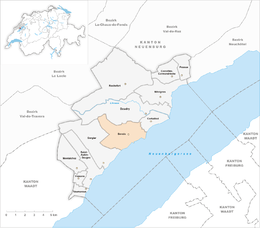
| Surrounded by | Boudry, Chevroux (VD), Cortaillod, Forel (FR), Gorgier | |
| Website |
www SFSO statistics |
|
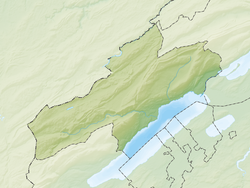
Bevaix is a municipality in the district of Boudry in the canton of Neuchâtel in Switzerland.
Bevaix is first mentioned in 998 as in villa Bevacensi. In 1139 it was mentioned as Betuaci.
The village of Bevaix is sited in front of a small plateau, near Lake Neuchâtel, on a location showing both Bronze Age and Neolithic settlement and a priory dating to 998. Discovery nearby of several dugout canoes and boats illuminated techniques of shipbuilding in Gallo-Roman times. The village was predominantly agricultural until the building of a railway station in 1860, and the drainage of the surrounding wetlands around 1900, when the area became increasingly residential. Local industry focuses on microtechnology.
Bevaix has an area, as of 2009[update], of 10.8 square kilometers (4.2 sq mi). Of this area, 3.68 km2 (1.42 sq mi) or 34.1% is used for agricultural purposes, while 5.08 km2 (1.96 sq mi) or 47.1% is forested. Of the rest of the land, 1.97 km2 (0.76 sq mi) or 18.3% is settled (buildings or roads) and 0.08 km2 (20 acres) or 0.7% is unproductive land.
Of the built up area, housing and buildings made up 10.2% and transportation infrastructure made up 4.3%. Power and water infrastructure as well as other special developed areas made up 2.3% of the area Out of the forested land, 45.6% of the total land area is heavily forested and 1.5% is covered with orchards or small clusters of trees. Of the agricultural land, 18.7% is used for growing crops and 8.2% is pastures, while 5.8% is used for orchards or vine crops and 1.4% is used for alpine pastures.
The municipality is located in the Boudry district, on a small, marshy plateau near Lake Neuchâtel.
The proposed merger of the municipalities of Bevaix, Boudry and Cortaillod was rejected by the residents.
The blazon of the municipal coat of arms is Impalled, Azure a Fish haurient Argent and a Bar Or, and Gules, a Fountain Argent and in chief two Mullets of Five of the same.
...
Wikipedia


