Cortaillod
| Cortaillod | ||
|---|---|---|

Vineyards outside Cortaillod village
|
||
|
||
| Coordinates: 46°57′N 6°51′E / 46.950°N 6.850°ECoordinates: 46°57′N 6°51′E / 46.950°N 6.850°E | ||
| Country | Switzerland | |
| Canton | Neuchâtel | |
| District | Boudry | |
| Area | ||
| • Total | 3.69 km2 (1.42 sq mi) | |
| Elevation | 484 m (1,588 ft) | |
| Population (Dec 2015) | ||
| • Total | 4,802 | |
| • Density | 1,300/km2 (3,400/sq mi) | |
| Postal code | 2016 | |
| SFOS number | 6408 | |
| Surrounded by | Bevaix, Boudry, Colombier | |
| Twin towns | Maienfeld (Switzerland) | |
| Website |
www SFSO statistics |
|
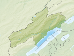
Cortaillod is a municipality in the district of Boudry in the canton of Neuchâtel in Switzerland.
The neolithic Cortaillod culture was named after Cortaillod, where four neolithic villages have been discovered.
Cortaillod is first mentioned in 1311 as Cortaillot.
Cortaillod gave its name to the Cortaillod culture, a neolithic culture in Switzerland and surrounding areas. There are four neolithic sites along the lake shore at Cortaillod; La Fabrique or Le Vivier which is now eroding, Les Cotes which was almost completely washed out in 1880, Petit-Cortaillod and La Tuillières. At La Tuillières several large flint and stone axes were found. Petit-Cortaillod is the largest and most productive. It is about 300 m × 60 m (980 ft × 200 ft) and is between 0.6 to 1.25 m (2 ft 0 in to 4 ft 1 in) thick. These sites were originally underwater, but were discovered when the water level of Lake Neuchâtel dropped. Because they were no longer flooded, between 1876 and 1879 the sites were looted. Many items were bought by museums or private collectors with limited study and documentation. The first scientific study was done in 1878 by Albert Vouga and Fritz Borel at the Petit-Cortaillod site. Their first excavations went down to a chalk layer at a depth of 1.25 m (4.1 ft). The list of objects excavated on this occasion is impressive: thousands of flints and awls made of bone, 3,000 ax shafts, and about 2,000 smaller axes and hatchets.
Ferdinand Keller and Frederic Troyon reported the discovery of lake shore settlements from the Late Bronze Age (1250-800 BC) in 1858. Friedrich Schwab and Edouard Desor's archeological excavations found many bronze items. One of the most striking items, a wheel spoke made of bronze and oak wood with a diameter of 51 cm (20 in), was discovered in 1862. Other finds included axes, sickles and needles as well as bronze swords and hundreds of vases. There were also a number of crescent-shaped earthenware objects called d'argile croissants. The d'argile croissants are about 30 cm (12 in) long and may represent constellations. After the first Jura water correction dropped the water levels by 2.7 m (8.9 ft), the sites began to erode. In 1925 Paul Vouga took soundings to study the stratigraphy of the site. At his request, the Army made a series of aerial photographs in 1927, which provided a number of fundamental insights into these villages from the Bronze Age.
...
Wikipedia


