Berrias-et-Casteljau
| Berrias-et-Casteljau | ||
|---|---|---|
| Commune | ||

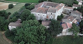
Commandery of Jalès
|
||
|
||
| Coordinates: 44°22′33″N 4°12′04″E / 44.3758°N 4.2011°ECoordinates: 44°22′33″N 4°12′04″E / 44.3758°N 4.2011°E | ||
| Country | France | |
| Region | Auvergne-Rhône-Alpes | |
| Department | Ardèche | |
| Arrondissement | Largentière | |
| Canton | Les Cévennes ardéchoises | |
| Intercommunality | Pays de Jalès | |
| Government | ||
| • Mayor (2008–2014) | Jean Ferole | |
| Area1 | 26.42 km2 (10.20 sq mi) | |
| Population (2008)2 | 640 | |
| • Density | 24/km2 (63/sq mi) | |
| Time zone | CET (UTC+1) | |
| • Summer (DST) | CEST (UTC+2) | |
| INSEE/Postal code | 07031 /07460 | |
| Elevation | 100–262 m (328–860 ft) (avg. 130 m or 430 ft) |
|
|
1 French Land Register data, which excludes lakes, ponds, glaciers > 1 km² (0.386 sq mi or 247 acres) and river estuaries. 2Population without double counting: residents of multiple communes (e.g., students and military personnel) only counted once. |
||
1 French Land Register data, which excludes lakes, ponds, glaciers > 1 km² (0.386 sq mi or 247 acres) and river estuaries.
Berrias-et-Casteljau is a commune in the Ardèche department in southern France.
The Chassezac flows southeast through the northern part of the commune, then forms part of its eastern border.
The Berriasian Age of the Cretaceous Period of geological time is named for the village of Berrias in the commune.
...
Wikipedia


