Berkeley Lake
| Berkeley Lake, Georgia | |
|---|---|
| City | |

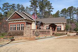
Berkeley Lake City Hall
|
|
 Location in Gwinnett County and the state of Georgia |
|
| Coordinates: 33°59′7″N 84°11′0″W / 33.98528°N 84.18333°WCoordinates: 33°59′7″N 84°11′0″W / 33.98528°N 84.18333°W | |
| Country | United States |
| State | Georgia |
| County | Gwinnett |
| Area | |
| • Total | 1.2 sq mi (3.1 km2) |
| • Land | 1.1 sq mi (2.8 km2) |
| • Water | 0.1 sq mi (0.3 km2) |
| Elevation | 1,056 ft (322 m) |
| Population (2010) | |
| • Total | 1,574 |
| • Estimate (2016) | 2,062 |
| • Density | 1,461/sq mi (564.1/km2) |
| Time zone | Eastern (EST) (UTC-5) |
| • Summer (DST) | EDT (UTC-4) |
| FIPS code | 13-07248 |
| GNIS feature ID | 1669469 |
| Website | www |
Berkeley Lake is a city in Gwinnett County, Georgia, United States. From its 1956 origins as a summer retreat, Berkeley Lake has grown into a thriving community centered on its 88-acre (360,000 m2) namesake lake. As of the 2010 census, the city had a population of 1,574. It has been named a Tree City USA for 18 years.
Berkeley Lake residents are mostly a mix of entrepreneurs, corporate executives, and other professionals. There is also a large number of artists and writers. With a median household income of $131,944, Berkeley Lake is the most affluent town in the state of Georgia.
Berkeley Lake is in western Gwinnett County, bordered by Duluth to the east, Peachtree Corners to the south and west, and Johns Creek to the north. The northern boundary of the city follows the Chattahoochee River, which is also the Fulton County line. Peachtree Industrial Boulevard is the main road through the city. The community consists of several subdivisions around an 88-acre (360,000 m2) private lake.
According to the United States Census Bureau, the city has a total area of 1.2 square miles (3.1 km2), of which 1.1 square miles (2.8 km2) is land and 0.1 square miles (0.3 km2), or 10.14%, is water.
As of the census of 2010, there were 1,574 people, 472 households, and 474 families residing in the city. The population density was 1,312 people per square mile (506/km²). There were 606 housing units at an average density of 505 per square mile (195.1/km²). The racial makeup of the city was 75.5% White, 5.7% African American, 0.1% Native American, 14.3% Asian, 1.3% from other races, and 3.1% from two or more races. Hispanic or Latino of any race were 3.6% of the population.
...
Wikipedia
