Beilstein (Spessart)
| Beilstein | |
|---|---|

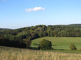
Beilstein seen from the southwest
|
|
| Highest point | |
| Elevation | 499 m (1,637 ft) |
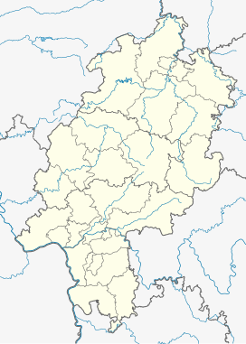
| Coordinates | 50°10′13″N 9°24′10″E / 50.17028°N 9.40278°ECoordinates: 50°10′13″N 9°24′10″E / 50.17028°N 9.40278°E |
| Geography | |
| Parent range | Spessart |
| Geology | |
| Mountain type | Basalt |
The Beilstein is a hill in the Main-Kinzig district of Hesse, Germany. It is part of the Spessart range and lies in the municipality of Jossgrund close to the Ortsteil of Lettgengrund. Its elevation is 499 metres above sea level.
The Beilstein is located at the end of the valley of the Jossa. It is part of the Mittelgebirge Spessart and lies in the Hessian part of the range, close to the border to Bavaria. The Beilstein lies between Lettgenbrunn and Bad Orb, just south of the 521 m high Hoher Berg.
The Beilstein is part of the municipal territory of Jossgrund.
Unlike most of the Spessart, which consists mainly of Buntsandstein, the Beilstein is an outcropping of basalt. The upper slopes of the hill are wooded, but at the top basalt rocks are exposed. Around 10-20 million years ago, volcanic activity caused this to break through the local Buntsandstein, which is roughly 200 million years older. The Beilstein features characteristic basalt columns and the largest basalt cave in the Main-Kinzig district.
On the peak are the remains of a medieval hill castle known as Burg Beilstein. The place is first mentioned in 1059 as Bilstein as part of the border of the territory of Fulda monastery, but at that point it was likely not a castle but just a landmark. In 1313, the castle was bought by the Electorate of Mainz from the lords of Hohenlohe-Brauneck along with the area around Lettgenbrunn. The castle is last mentioned in 1427. Two important ancient trade routes, the Eselsweg and the Birkenhainer Strasse pass through the area. The former is overlooked by the Beilstein and was the likely reason for the castle's construction. Today, only the foundation of a wall remains of the castle.
...
Wikipedia

