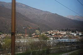
Bedano
| Bedano | ||
|---|---|---|
 |
||
|
||
| Coordinates: 46°03′N 8°55′E / 46.050°N 8.917°ECoordinates: 46°03′N 8°55′E / 46.050°N 8.917°E | ||
| Country | Switzerland | |
| Canton | Ticino | |
| District | Lugano | |
| Government | ||
| • Mayor | Sindaco | |
| Area | ||
| • Total | 1.87 km2 (0.72 sq mi) | |
| Elevation | 387 m (1,270 ft) | |
| Population (Dec 2015) | ||
| • Total | 1,544 | |
| • Density | 830/km2 (2,100/sq mi) | |
| Postal code | 6930 | |
| SFOS number | 5148 | |
| Surrounded by | Alto Malcantone, Gravesano, Lamone, Torricella-Taverne | |
| Website |
http://www.bedano.ch SFSO statistics |
|
Bedano is a municipality in the district of Lugano in the canton of Ticino in Switzerland.
During the Middle Ages it was under the jurisdiction of the monastery of S. Ambrogio in Milan, while the Bishop of Como possessed the right to tithe in Bedano.
It is part of the parish of Gravesano. In the village there are two chapels, the Chapel of Santa Maria (built in 1365, rebuilt before 1636) and S. Rocco from the 16th Century. North of Bedano are ruins of a small castle, which may have belonged to the Rusca family. Under Swiss Confederation rule, it was as a part of the district of Lugano.
At times, the a large percentage of the population emigrated, due to poor conditions in the village. It is the original home of the artist and architect family, Albertolli, including Giocondo Albertolli. Like the rest of Vedeggio valley, in recent decades it has experienced, industrial growth, aided by a freight rail station at Bioggio.
Bedano has an area, as of 1997[update], of 1.87 square kilometers (0.72 sq mi). Of this area, 0.55 km2 (0.21 sq mi) or 29.4% is used for agricultural purposes, while 1 km2 (0.39 sq mi) or 53.5% is forested. Of the rest of the land, 0.52 km2 (0.20 sq mi) or 27.8% is settled (buildings or roads), 0.06 km2 (15 acres) or 3.2% is either rivers or lakes and 0.03 km2 (7.4 acres) or 1.6% is unproductive land.
Of the built up area, industrial buildings made up 6.4% of the total area while housing and buildings made up 13.9% and transportation infrastructure made up 6.4%. Power and water infrastructure as well as other special developed areas made up 1.1% of the area Out of the forested land, 46.5% of the total land area is heavily forested and 7.0% is covered with orchards or small clusters of trees. Of the agricultural land, 15.0% is used for growing crops and 13.9% is used for alpine pastures. All the water in the municipality is flowing water.
...
Wikipedia


