Bayındır
| Bayındır | |
|---|---|
 |
|
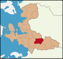
 Bayındır District within the Province of İzmir |
|
| Bayındır District within the Province of İzmir | |
| Coordinates: 38°13′09″N 27°38′53″E / 38.21917°N 27.64806°ECoordinates: 38°13′09″N 27°38′53″E / 38.21917°N 27.64806°E | |
| Country | Turkey |
| Province | İzmir |
| Government | |
| • Mayor | Mehmet Kertiş (AKP) |
| Area | |
| • District | 540.22 km2 (208.58 sq mi) |
| Population (2012) | |
| • Urban | 21,785 |
| • District | 40,988 |
| • District density | 76/km2 (200/sq mi) |
Bayındır is a district of İzmir Province of Turkey and the central town of the district which is situated in the valley of the Küçük Menderes.
Its name in antiquity was Caystrus. Its present name derives from the first Turkish settlers in the region who were members of the Bayındır clan, one of the 24 original Oghuz clans. In 1997, the town population was 18,100. It is connected with İzmir by a branch of the Aydın railway, and has a trade in olives, olive oil, cotton, figs, raisins and tobacco.
The district is crossed by the Torbalı-Tire railway, with a branch to Ödemiş. It is served by regional trains from/to İzmir (Basmane-Ödemiş and Basmane-Tire), and counts the stations of Arıkbaşı, Karpuzlu, Elifli, Furunlu, Bayındır (in the capital town), Yakaköy and Çatal.
...
Wikipedia

