Baxter Springs, Kansas
| Baxter Springs, Kansas | |
|---|---|
| City | |

Downtown Baxter Springs (2008)
|
|
 Location within Cherokee County and Kansas |
|
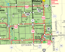
 KDOT map of Cherokee County (legend) |
|
| Coordinates: 37°1′23″N 94°44′5″W / 37.02306°N 94.73472°WCoordinates: 37°1′23″N 94°44′5″W / 37.02306°N 94.73472°W | |
| Country | United States |
| State | Kansas |
| County | Cherokee |
| Incorporated | 1868 |
| Government | |
| • Type | Mayor–Council |
| • Mayor | Randy Trease |
| Area | |
| • Total | 3.19 sq mi (8.26 km2) |
| • Land | 3.11 sq mi (8.05 km2) |
| • Water | 0.08 sq mi (0.21 km2) |
| Elevation | 843 ft (257 m) |
| Population (2010) | |
| • Total | 4,238 |
| • Estimate (2015) | 4,028 |
| • Density | 1,300/sq mi (510/km2) |
| Time zone | CST (UTC-6) |
| • Summer (DST) | CDT (UTC-5) |
| ZIP code | 66713 |
| Area code | 620 |
| FIPS code | 20-04625 |
| GNIS ID | 1669487 |
| Website | BaxterSprings.us |
Baxter Springs is a city in Cherokee County, Kansas, United States, and located along Spring River. As of the 2010 census, the city population was 4,238. It is the most populous city of Cherokee County.
From an early trading post, the city grew dramatically with the expansion of cattle ranching in the West and was the first "cow town" in Kansas following the Civil War. its population grew dramatically into the early 1870s in association with the cattle drives. After railroads were constructed into Texas, cattle drives no longer were made to Baxter Springs and other points along the trail, and the towns declined.
The city later had some economic success in the early twentieth century associated with lead mining in the area. The city protected its land, and owners and operators chose Baxter Springs for their residences and business offices. In 1926 the city's downtown main street was designated as part of the transcontinental U.S. Route 66 from Chicago to Los Angeles. By the 1940s, the high-quality lead had mostly been mined, and the industry declined. Some towns nearby disappeared altogether. Environmental restoration to correct damage left by mining has been underway for some time.
For thousands of years, indigenous peoples had lived along the waterways throughout the west. The Osage migrated west from the Ohio River area of Kentucky, driven out by the Iroquois. They settled in Kansas by the mid-17th century, adopting plains traditions, where they competed with other tribes. By 1750 they dominated much of the region of Kansas, Missouri and Oklahoma.
One of the largest Osage bands was led by Chief Black Dog (Manka - Chonka); his men completed the Black Dog Trail by 1803. It started from their winter territory east of Baxter Springs and extended southwest to their summer hunting grounds at the Great Salt Plains in present-day Alfalfa County, Oklahoma. The Osage stopped at the springs for healing on their way to summer hunting grounds. They made the trail by clearing it of brush and large rocks, and constructing earthen ramps to the fords. Wide enough for eight horsemen to ride abreast, the trail was the first improved road in Kansas and Oklahoma.
...
Wikipedia
