Battle of Prairie D'Ane
| Battle of Prairie D'Ane | |||||||
|---|---|---|---|---|---|---|---|
| Part of the American Civil War | |||||||
|
|||||||
| Belligerents | |||||||
|
|
|
||||||
| Commanders and leaders | |||||||
|
|
|
||||||
| Units involved | |||||||
| Army of Arkansas | District of Arkansas | ||||||
| Strength | |||||||
| 13,000 | 7,000 | ||||||
| Casualties and losses | |||||||
| 100 | 50 | ||||||
|
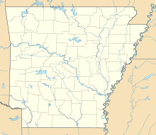
Location within the state of Arkansas
|
|||||||
The Battle of Prairie D'Ane (April 9 – 13, 1864) (also known as Prairie De Ann, Gum Grove, and Moscow) was fought in present-day Nevada County, Arkansas, as part of the Camden Expedition, during the American Civil War. The Camden Expedition was launched in cooperation with the Red River Campaign of 1864. U.S. planners envisioned two federal armies converging simultaneously, one force under the command of General Nathaniel Banks pressing northward up the Red River commencing at Alexandria, Louisiana and the other federal army under the command of General Frederick Steele driving southwestward from Little Rock Arkansas. The objective was to press the rebel army of General E. Kirby Smith back upon the rebel stronghold at Shreveport and defeat him. If successful, a somewhat vague second phase envisioned the two federal armies combining into one large force and continuing their offensive with a westward push into Texas.
Prairie D'Ane was a prominent topographical feature in southwest Arkansas consisting of an open prairie 20 miles square, surrounded on all sides primarily by dense pine forest. In 1864 it was a well-known landmark some one hundred miles southwest of Little Rock. The prairie was a crossroads; to the west lay Washington, Confederate capital of Arkansas since their abandonment of Little Rock in September 1863. To the east of the prairie lay the heavily fortified city of Camden, where many Confederate troops were headquartered. To the south of Prairies D'Ane lay the strategic Red River and Shreveport beyond.
Prairie D'Ane became a strategic locale after the US Army Captured Little Rock on 10 September 1863. As Union forces marched into the city, the Confederates hastily gathered up their official state documents and moved their seat of government to Washington. In their retreat to the southwest, the Confederates constructed defensive works at several points along the old military road running from Benton to Arkadelphia and they built extensive earthen and log breastworks at the northern edge of Prairie D'Ane. A Confederate defeat on the prairie would lay open the route to Washington for the federal army. But Prairie D'Ane posed a difficult defensive problem for the rebels. On the one hand, it's wide open plain offered good fields of fire for defending artillery batteries; on the other hand, the same open country offered an attacking force plenty of space in which to maneuver and outflank the defenders in their fixed entrenchments. Much of the heavy rebel defensive barriers erected along the route from Little Rock to Prairie D'Ane had been built by slave labor. Roving groups of rebel guerrilla cavalry meanwhile were dispatched to harass federal forces along their line of march from Little Rock.
...
Wikipedia

