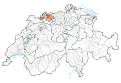
Basel-Land
| Kanton Basel-Landschaft | ||
|---|---|---|
| Canton of Switzerland | ||
|
||
 Location in Switzerland |
||
| Coordinates: 47°7′N 7°44′E / 47.117°N 7.733°ECoordinates: 47°7′N 7°44′E / 47.117°N 7.733°E | ||
| Capital | Liestal | |
| Largest City | Allschwil | |
| Subdivisions | 86 municipalities, 5 districts | |
| Government | ||
| • Executive | Regierungsrat (5) | |
| • Legislative | Landrat (90) | |
| Area | ||
| • Total | 517.56 km2 (199.83 sq mi) | |
| Population (03/2016) | ||
| • Total | 285,094 | |
| • Density | 550/km2 (1,400/sq mi) | |
| ISO 3166 code | CH-BL | |
| Highest point | 1,169 m (3,835 ft): Hinteri Egg | |
| Lowest point | 246 m (807 ft): confluence of Birs river with the Rhine, at Birsfelden | |
| Joined | 1501 | |
| Languages | German | |
| Website | BL.ch | |
The canton of Basel-Landschaft (German: ![]() Basel-Landschaft , English: Basel-Country; informally: Baselland/Baselbiet, French: Bâle-Campagne), is one of the 26 cantons of Switzerland. The capital is Liestal. It shares borders with the cantons of Basel-Stadt, Solothurn, Jura and Aargau, and with the French région of Alsace and the German state of Baden-Württemberg.
Basel-Landschaft , English: Basel-Country; informally: Baselland/Baselbiet, French: Bâle-Campagne), is one of the 26 cantons of Switzerland. The capital is Liestal. It shares borders with the cantons of Basel-Stadt, Solothurn, Jura and Aargau, and with the French région of Alsace and the German state of Baden-Württemberg.
Basel-Landschaft, together with Basel-Stadt, formed the historic Canton of Basel until they separated following the uprising of 1833 (Battle of the Hülftenschanz near Frenkendorf).
In Roman times, the area of Basel was a centre of Roman activity. There are well-preserved remains at the site of Augusta Raurica in the canton of Basel-Landschaft. Around AD 200 there were about 20,000 people living in this city, now part of the much smaller Augst. The remains are on display in an open-air museum. The museum attracts over 140,000 visitors per year. Many of these visitors are schoolchildren from other parts of Switzerland. The site of Augusta Raurica includes the best-preserved amphitheatre north of the Alps, and a reconstructed Roman villa.
...
Wikipedia


