Barrmill
| Barrmill | |
|---|---|
 Barrmill from the old railway bridge |
|
| Barrmill shown within North Ayrshire | |
| Council area | |
| Lieutenancy area | |
| Country | Scotland |
| Sovereign state | United Kingdom |
| Dialling code | 01505 |
| Police | Scottish |
| Fire | Scottish |
| Ambulance | Scottish |
| EU Parliament | Scotland |
| UK Parliament | |
| Scottish Parliament | |
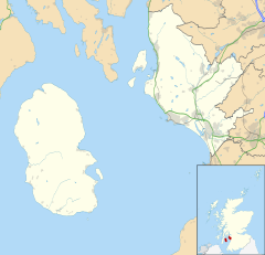
Barrmill is a small village in North Ayrshire, Scotland about a mile and a half a mile east of Beith on the road to Burnhouse and Lugton. Locally it is known as the Barr.
General Roy's survey of 1747 - 55 shows only the farm of High Barr. A village grew up here due to the employment provided by the several limestone quarries that were present at one time, the Dockra Ironstone pit that was located near the railway line down from Dockra quarry in 1912, and other local industries.
The village that developed had a population of 300 in 1876 and 600 in 1951, when the threadmaking industry had just ceased, although the workers still lived in company houses and were transported daily to the threadmaking factory at Kilbirnie. This mill was founded in the mid-19th century to make linen thread, much used at the time for boot and shoe making, and for sailmaking; an offshoot of the much larger linen thread mills at Kilbirnie. The largest of the mill buildings was a three-storeyed, flat-roofed mill, with a fireproof interior with brick arches on cast iron columns. In front is a section of a range of single-storeyed, north-lit sheds. In 1965 the buildings were being used as a fertiliser factory. The mill buildings have been demolished, but the offices still survive.
The limestone works was closed in 1972. The whinstone quarries of Messrs. King & Co. employed a considerable number of men in 1951, but even then the quarries were almost worked out. Giffen coal pit (No 1) lay close to Bankhead Moss as shown on the 1897 OS map, closing not long afterwards as the following OS maps cease showing it.
The 1912 OS map marks the quoiting ground which was located in what is now the park, close to the old railway embankment; a mission hall is also shown, located just the other side of the railway bridge over the Beith branchline. In 2006 a new housing estate was created on the site of the old Barrmill railway station and goods yard.
Birsieknowe was located in the grounds of what is now DM Beith (2010) and the old coal pit here closed due to flooding beyond the capacity of the pumps in 1913; it had been active in the 1890s. A commemorative plaque was placed at the site.
Barrmill railway station was the only intermediate station on the line from Lugton to Beith Town railway station and opened on 26 June 1873, and closed permanently to passengers on 5 November 1962. Freight services continued on the line until 1964.
The old railway line running towards Lugton at Barmill
Approaching Barrmill from Lugton near the old Kilbirnie Junction
...
Wikipedia

