Barneveld (municipality)
| Barneveld | |||
|---|---|---|---|
| Municipality | |||

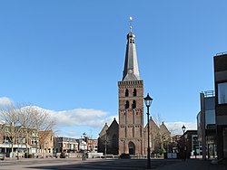
Church in Barneveld
|
|||
|
|||
 Location in Gelderland |
|||
| Coordinates: 52°8′N 5°35′E / 52.133°N 5.583°ECoordinates: 52°8′N 5°35′E / 52.133°N 5.583°E | |||
| Country | Netherlands | ||
| Province | Gelderland | ||
| Government | |||
| • Body | Municipal council | ||
| • Mayor | Asje van Dijk (CDA) | ||
| Area | |||
| • Total | 176.69 km2 (68.22 sq mi) | ||
| • Land | 175.96 km2 (67.94 sq mi) | ||
| • Water | 0.73 km2 (0.28 sq mi) | ||
| Elevation | 10 m (30 ft) | ||
| Population (August 2017) | |||
| • Total | 57,036 | ||
| • Density | 324/km2 (840/sq mi) | ||
| Demonym(s) | Barnevelder | ||
| Time zone | CET (UTC+1) | ||
| • Summer (DST) | CEST (UTC+2) | ||
| Postcode | 3770–3785, 3794, 3886 | ||
| Area code | 0342, 0577 | ||
| Website | www |
||
Barneveld (![]() pronunciation ) is a municipality in the province of Gelderland in the center of the Netherlands. It is known for its poultry industry and large Protestant community. The municipality had a population of 57,036 in 2017, out of which 29,756 (2010) lived in the town itself.
pronunciation ) is a municipality in the province of Gelderland in the center of the Netherlands. It is known for its poultry industry and large Protestant community. The municipality had a population of 57,036 in 2017, out of which 29,756 (2010) lived in the town itself.
...
Wikipedia


