Barboursville, West Virginia
| Barboursville, West Virginia | |
|---|---|
| Village | |

Main Street in Barboursville in 2007
|
|
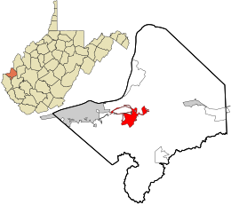
 Location in Cabell County and the state of West Virginia. |
|
| Coordinates: 38°24′40″N 82°17′52″W / 38.41111°N 82.29778°WCoordinates: 38°24′40″N 82°17′52″W / 38.41111°N 82.29778°W | |
| Country | United States |
| State | West Virginia |
| County | Cabell |
| Area | |
| • Total | 4.19 sq mi (10.85 km2) |
| • Land | 4.09 sq mi (10.59 km2) |
| • Water | 0.10 sq mi (0.26 km2) |
| Elevation | 581 ft (177 m) |
| Population (2010) | |
| • Total | 3,964 |
| • Estimate (2012) | 4,065 |
| • Density | 969.2/sq mi (374.2/km2) |
| Time zone | Eastern (EST) (UTC-5) |
| • Summer (DST) | EDT (UTC-4) |
| ZIP code | 25504 |
| Area code(s) | 304 |
| FIPS code | 54-04276 |
| GNIS feature ID | 1553799 |
Barboursville is a village in Cabell County, West Virginia, United States. It is located near the second largest city in the state, Huntington. The population was 3,964 at the 2010 census.
Barboursville is a part of the Huntington-Ashland, WV-KY-OH, Metropolitan Statistical Area (MSA). As of the 2010 census, the MSA had a population of 287,702. New definitions from February 28, 2013 placed the population at 363,000.
Barboursville was platted in 1813.
The Barboursville Historic District was listed on the National Register of Historic Places in 2008. The Thornburg House was separately listed in 1991.
Barboursville is located at 38°24′40″N 82°17′52″W / 38.41111°N 82.29778°W (38.411002, -82.297758). According to the United States Census Bureau, the village has a total area of 4.19 square miles (10.85 km2), of which, 4.09 square miles (10.59 km2) is land and 0.10 square miles (0.26 km2) is water. The confluence of the Mud River and the Guyandotte River is just north of the village.
As of the census of 2010, there were 3,964 people, 1,528 households, and 904 families residing in the village. The population density was 969.2 inhabitants per square mile (374.2/km2). There were 1,625 housing units at an average density of 397.3 per square mile (153.4/km2). The racial makeup of the village was 94.1% White, 3.1% African American, 0.2% Native American, 1.3% Asian, 0.1% from other races, and 1.2% from two or more races. Hispanic or Latino of any race were 0.7% of the population.
...
Wikipedia
