Baranquilla
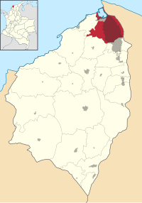
| Barranquilla | |||
|---|---|---|---|
| Municipality and city | |||

Top left:A Simon Bolivar monument in Barranquilla Bolivar Square, Top right:A panoramic view of centro (downtown) area, Middle left:right:Barranquilla Custom Office, Middle right:Catedral del Metropolitana Maria Rena (Maria Rena Metropolitan Cathedral), Bottom left:Caribbean Pilot Library (Biblioteca Piloto del Caribe), Bottom right:Barrio El Prado residential area
|
|||
|
|||
| Nickname(s): La Puerta de Oro de Colombia | |||
| Motto: "Barranquilla blooms for everyone!" (Spanish: Barranquilla florece para todos). | |||
 Atlántico Department |
|||
| Atlántico Department | |||
| Coordinates: 10°57′50″N 74°47′47″W / 10.96389°N 74.79639°WCoordinates: 10°57′50″N 74°47′47″W / 10.96389°N 74.79639°W | |||
| Country |
|
||
| Region | Caribbean | ||
| Department | Atlántico | ||
| Established | April 7, 1813 | ||
| Government | |||
| • Mayor |
Alejandro Char (Radical Change) |
||
| Elevation | 18 m (59 ft) | ||
| Population (2005) | |||
| • Municipality and city | 1,148,506 Ranked 4th | ||
| • Metro | 2,370,753 | ||
| Demonym(s) | Barranquillero/a(s), Currambero/a(s) | ||
| Postal code | 080020 | ||
| Area code(s) | 57 + 5 | ||
| HDI (2006) | 0.821 – high | ||
| Website |
www |
||
| Economic indicators | |
|---|---|
| GDP: (2006) |
US $4,605 million COP $10,858,185 million |
| GDP per capita: (2006) |
US $2,209 COP $4,945,029 |
|
Unemployment rate: (2010) |
9.2% |
| Annual inflation: (2010) |
3.38% |
| Monthly inflation: (2010) |
0.28% |
|
Country risk: (2009) |
38.85 points |
| Data retrieved from the Barranquilla Chamber of Commerce – Source: DANE. | |
Barranquilla (American Spanish: [baraŋˈkiʝa]) is a city and municipality located in northern Colombia. It is the only major city in South America that was populated before its formal foundation. Barranquilla is located near the Caribbean Sea. The city is located in the Atlántico Department, of which it is the capital. Barranquilla is the largest city and port in the northern Caribbean Coast region of Colombia, with a population of 2,370,753 as of 2011[update] in its metropolitan area, which makes it Colombia's fourth most populous city after Bogotá, Medellín and Cali.
Barranquilla lies strategically next to the delta of the Magdalena River, 7.5 kilometres (4.7 miles) (originally 25 kilometres (16 miles) before rapid urban growth) from its mouth at the Caribbean Sea, serving as port for river and maritime transportation within Colombia. It is also the main industrial, shopping, educational and cultural centre of the Caribbean Region of Colombia. The city is the core of the Metropolitan Area of Barranquilla, which also includes the municipalities of Soledad, Galapa, Malambo, and Puerto Colombia.
Barranquilla was legally established as a town on April 7, 1813, although it dated from at least 1629. It grew into an important port, serving as a haven for immigrants from Europe, especially during and immediately following World War I and World War II, when waves of additional immigrants from the Middle East and Asia arrived. Barranquilla became Colombia's principal port, and with its level of industrialization and modernity earned the city the nickname Colombia's Golden Gate (Spanish: La Puerta de Oro de Colombia). In the 1940s, Barranquilla was the second largest city in Colombia and one of the most modern cities in the Caribbean and in South America, while later, local administrations, due to widespread corruption in their ranks, brought about a decline in the standard of living. As government investment increased in other Colombian cities, Barranquilla's national position was eclipsed.
...
Wikipedia


