Baraga County
| Baraga County, Michigan | ||
|---|---|---|

Baraga County Courthouse and annex, July 2014
|
||
|
||
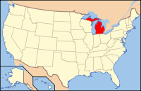
 Location in the U.S. state of Michigan |
||
 Michigan's location in the U.S. |
||
| Founded | February 19, 1875 | |
| Named for | Frederic Baraga | |
| Seat | L'Anse | |
| Largest village | Baraga | |
| Area | ||
| • Total | 1,069 sq mi (2,769 km2) | |
| • Land | 898 sq mi (2,326 km2) | |
| • Water | 171 sq mi (443 km2), 16% | |
| Population | ||
| • (2010) | 8,860 | |
| • Density | 9.9/sq mi (4/km²) | |
| Congressional district | 1st | |
| Time zone | Eastern: UTC-5/-4 | |
| Website | www |
|
Baraga County (/ˈbærəɡə/ BARR-ə-gə) is a county in the Upper peninsula in the U.S. state of Michigan. As of the 2010 census, the population was 8,860. The county seat is L'Anse. The county is named after Bishop Frederic Baraga. The L'Anse Indian Reservation of the Ojibwa is located within the county.
According to the U.S. Census Bureau, the county has a total area of 1,069 square miles (2,770 km2), of which 898 square miles (2,330 km2) is land and 171 square miles (440 km2) (16%) is water.
The county is located in the state's Upper Peninsula on the shore of Lake Superior, at the southeast base of the Keweenaw Peninsula. The villages of Baraga and L'Anse are located at the base of Lake Superior's Keweenaw Bay. Point Abbaye projects from the county, creating the Huron Bay. Mount Arvon is the highest natural point in Michigan at 1,979 feet (603 m).
...
Wikipedia

