Bar-sur-Seine
| Bar-sur-Seine | ||
|---|---|---|

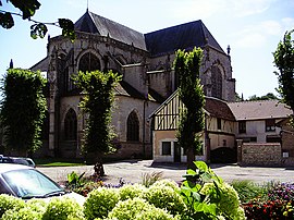
St Stephen's Church
|
||
|
||
| Coordinates: 48°06′53″N 4°22′36″E / 48.1147°N 4.3767°ECoordinates: 48°06′53″N 4°22′36″E / 48.1147°N 4.3767°E | ||
| Country | France | |
| Region | Grand Est | |
| Department | Aube | |
| Arrondissement | Troyes | |
| Canton | Bar-sur-Seine | |
| Intercommunality | Barséquanais | |
| Government | ||
| • Mayor (2008–2020) | Marcel Hurillon | |
| Area1 | 27.53 km2 (10.63 sq mi) | |
| Population (2010)2 | 3,233 | |
| • Density | 120/km2 (300/sq mi) | |
| Time zone | CET (UTC+1) | |
| • Summer (DST) | CEST (UTC+2) | |
| INSEE/Postal code | 10034 / 10110 | |
| Elevation | 147–293 m (482–961 ft) | |
|
1 French Land Register data, which excludes lakes, ponds, glaciers > 1 km² (0.386 sq mi or 247 acres) and river estuaries. 2Population without double counting: residents of multiple communes (e.g., students and military personnel) only counted once. |
||
1 French Land Register data, which excludes lakes, ponds, glaciers > 1 km² (0.386 sq mi or 247 acres) and river estuaries.
Bar-sur-Seine is a French commune in the Aube department in the Grand Est region of north-central France.
The inhabitants of the commune are known as Barrois or Barroises and Barséquanais or Barséquanaises.
The commune has been awarded three flowers by the National Council of Towns and Villages in Bloom in the Competition of cities and villages in Bloom.
Bar-sur-Seine is located some 20 km south-east of Troyes and 25 km north-west of Montliot-et-Courcelles. Access to the commune is by the D671 road from Virey-sous-Bar in the north-west which passes through the town and continues south-east to Celles-sur-Ource. The D443 comes from Magnant in the north-east also passing through the village and continuing south-west to Villemorien. The D63 also goes to Magnant by a slightly longer route. The D4 goes from the town to Ville-sur-Arce in the south-east. The D49 branches from the D443 on the right bank of the Seine and goes north-west to Courtenot. There is also the railway passing through the commune from Saint-Parres-lès-Vaudes in the north-east and continuing to the next station at Polisot in the south-east. Apart from the town there are the hamlets of Avaleur and La Bordé. There are large forests to the north-east and south-west of the town with the rest of the commune farmland.
The Seine river flows through the commune and the town from south-east to north-west and continues north-west to Troyes and beyond. The Ource river flows from the south-east and forms part of the south-eastern border before joining the Seine at the border of the commune. The Arce river joins the Seine on the right bank on the south-eastern border of the commune.
...
Wikipedia


