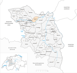
Bannwil
| Bannwil | ||
|---|---|---|

Historic Bannwil train station
|
||
|
||
| Coordinates: 47°14′N 7°44′E / 47.233°N 7.733°ECoordinates: 47°14′N 7°44′E / 47.233°N 7.733°E | ||
| Country | Switzerland | |
| Canton | Bern | |
| District | Oberaargau | |
| Area | ||
| • Total | 4.79 km2 (1.85 sq mi) | |
| Elevation | 434 m (1,424 ft) | |
| Population (Dec 2015) | ||
| • Total | 699 | |
| • Density | 150/km2 (380/sq mi) | |
| Postal code | 4913 | |
| SFOS number | 0323 | |
| Surrounded by | Aarwangen, Berken, Graben, Niederbipp, Oberbipp, Schwarzhäusern, Walliswil bei Niederbipp | |
| Website |
www SFSO statistics |
|
Bannwil is a municipality in the Oberaargau administrative district in the canton of Bern in Switzerland.
Bannwil is first mentioned in 1262 as Benwile.
The area around Bannwil was inhabited during the Hallstatt era and the Early Middle Ages. During the Middle Ages, Bannwil was part of the low court of Aarwangen and the district court of Buchsgau. These two courts began to come under Bernese control in 1432 and by 1463 were completely part of Bern. Over the following centuries, Bannwil alternated between the bailiwicks of Bipp and Aarwangen. Finally in the 17th century it was finally assigned to Aarwangen.
The village church was first mentioned in 1304. The current building was built in 1522 and rebuilt in 1679. In 1320 the church was given by the Count of Frohburg to the monastery of Schöntal. In 1528 control of the church was given to Bern.
In 1904 a hydroelectric power plant opened in Bannwil. It was replaced in 1970 by the Aarekraftwerk-Bannwil hydroelectric power plant. In 1907 the Langenthal-Niederbipp railroad line was built through Bannwil. The railroad opened up the municipality and allowed commuters to live in Bannwil. By 1990, over half of the workers in the municipality commuted to jobs outside it.
Bannwil has an area of 4.79 km2 (1.85 sq mi). Of this area, 2.2 km2 (0.85 sq mi) or 45.9% is used for agricultural purposes, while 1.88 km2 (0.73 sq mi) or 39.2% is forested. Of the rest of the land, 0.42 km2 (0.16 sq mi) or 8.8% is settled (buildings or roads), 0.24 km2 (0.093 sq mi) or 5.0% is either rivers or lakes and 0.01 km2 (2.5 acres) or 0.2% is unproductive land.
Of the built up area, housing and buildings made up 4.8% and transportation infrastructure made up 2.3%. Out of the forested land, 37.2% of the total land area is heavily forested and 2.1% is covered with orchards or small clusters of trees. Of the agricultural land, 33.6% is used for growing crops and 10.9% is pastures, while 1.5% is used for orchards or vine crops. All the water in the municipality is flowing water.
...
Wikipedia


