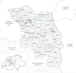
Berken
| Berken | |
|---|---|
| Coordinates: 47°14′N 7°43′E / 47.233°N 7.717°ECoordinates: 47°14′N 7°43′E / 47.233°N 7.717°E | |
| Country | Switzerland |
| Canton | Bern |
| District | Oberaargau |
| Government | |
| • Mayor | Hans Geissbühler |
| Area | |
| • Total | 1.39 km2 (0.54 sq mi) |
| Elevation | 420 m (1,380 ft) |
| Population (Dec 2015) | |
| • Total | 40 |
| • Density | 29/km2 (75/sq mi) |
| Postal code | 3376 |
| SFOS number | 0972 |
| Surrounded by | Bannwil, Graben, Heimenhausen, Walliswil bei Niederbipp, Walliswil bei Wangen |
| Website |
www SFSO statistics |
Berken is a municipality in the Oberaargau administrative district in the canton of Bern in Switzerland.
Berken is first mentioned in 1272 as Berinkon.
A few scattered mesolithic and neolithic artifacts have been found in the municipality, from prehistoric settlements in the Aare valley. During the Middle Ages it was a small farming settlement in the Herrschaft and later bailiwick of Aarwangen. Following the 1798 French invasion and the creation of the Helvetic Republic Berken left the Aarwangen bailiwick. After the collapse of the Republic and 1803 Act of Mediation it joined the newly created Wangen District.
It is part of the Graben school district.
Today agriculture provides over one third of jobs in the municipality, with the remaining jobs in gravel mining, concrete work and the local restaurant.
Berken has an area of 1.39 km2 (0.54 sq mi). As of the 2005/06 survey, a total of 0.74 km2 (0.29 sq mi) or 53.2% is used for agricultural purposes, while 0.42 km2 (0.16 sq mi) or 30.2% is forested. Of rest of the municipality 0.16 km2 (0.062 sq mi) or 11.5% is settled (buildings or roads), 0.06 km2 (15 acres) or 4.3% is either rivers or lakes and 0.02 km2 (4.9 acres) or 1.4% is unproductive land.
From the same survey, housing and buildings made up 3.6% and transportation infrastructure made up 3.6%. Power and water infrastructure as well as other special developed areas made up 3.6% of the area A total of 28.8% of the total land area is heavily forested and 1.4% is covered with orchards or small clusters of trees. Of the agricultural land, 41.7% is used for growing crops and 10.8% is pasturage. All the water in the municipality is flowing water.
...
Wikipedia


