Baleswar District
|
Balasore ବାଲେଶ୍ଵର ଜିଲ୍ଲା |
|
|---|---|
| District | |

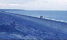
Chandipur Beach
|
|
| Nickname(s): Granary of Odisha | |
 Location in Odisha, India |
|
| Coordinates: 21°30′N 86°54′E / 21.5°N 86.9°ECoordinates: 21°30′N 86°54′E / 21.5°N 86.9°E | |
| Country |
|
| State | Odisha |
| Headquarters | Balasore |
| Area | |
| • Total | 3,634 km2 (1,403 sq mi) |
| Elevation | 90.08 m (295.54 ft) |
| Population (2011) | |
| • Total | 2,317,419 |
| • Rank | 4 |
| • Density | 609/km2 (1,580/sq mi) |
| Languages | |
| • Official | Odia, English |
| Time zone | IST (UTC+5:30) |
| PIN | 756 xxx |
| Telephone code | 06782 |
| Vehicle registration | OD-01 |
| Coastline | 81 kilometres (50 mi) |
| Sex ratio | 957 ♂/♀ |
| Literacy | 80.66% |
| Climate | Aw (Köppen) |
| Precipitation | 1,583 millimetres (62.3 in) |
| Avg. summer temperature | 43.1 °C (109.6 °F) |
| Avg. winter temperature | 10.6 °C (51.1 °F) |
| Website | baleswar |
| General Information | |
|---|---|
| Subdivisions: | 2 |
| Blocks: | 12 |
| Towns: | 4 |
| Municipalities: | 1 |
| N.A.C.: | 3 |
| Tehsils: | 7 |
| Grama panchayat: | 289 |
| Villages: | 2971 |
| Coast line: | 81 km |
Balasore District(Odia: ) also known as Baleswar District or Baleshwar District, is an administrative district of Odisha state in eastern India. Balasore is one of the coastal Districts of Odisha. It lies on the northernmost part of the state. It was a part of the ancient Kalinga which later became a territory of Toshal or Utkal, till the death of Mukunda Dev. Balasore as a separate District was created in October 1828. originally it was in Bengal presidency.
Balasore District covers an area of 3,634 km2 (1,403 sq mi) having total population of 23,17,419 as per 2011 census. The District is surrounded by Paschim Medinipur district of West Bengal in its northern side, Bay of Bengal in its east, Bhadrak district in its south and Mayurbhanj and Kendujhar Districts lies on its western side. The District is located at 20.48 to 21.59 North Latitude and 86.16 to 87.29 east Longitude.
It is now a launch station for missiles and sounding rockets on the east coast of India in Odisha state at 21°18' N and 86°36' E. Balasore has been in use since 1989, but unlike Sriharikota, it is not used for launching satellites. The rocket launching site at Balasore is situated in a place called Chandipur located on the Bay of Bengal. The Integrated Test Range in Chandipur is responsible for carrying out tests for various missiles such as Agni, Prithvi, Trishul etc.
Balasore Railway Station falls en route on the main line connecting Chennai to Kolkata. Road connectivity wise, National Highway-5 runs through Balasore. It is 212 kilometres (132 mi) north-east of Bhubaneswar by road. Chandipur-on-sea is a sea resort famous for its mile long shallow beaches. Chandipur on sea is one of the shallowest sea beaches in the world. It is a unique beach, the tide comes to the shore only four times a day, at determined intervals. Among other tourist attractions is the 18th century kshirochora-gopinath temple, famous for its mythological story, how the temple was built there.
...
Wikipedia
