Bailey's Prairie, Texas
| Bailey's Prairie, Texas | |
|---|---|
| Village | |
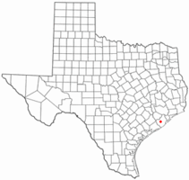
 Location of Bailey's Prairie, Texas |
|
 |
|
| Coordinates: 29°9′29″N 95°29′28″W / 29.15806°N 95.49111°WCoordinates: 29°9′29″N 95°29′28″W / 29.15806°N 95.49111°W | |
| Country | United States |
| State | Texas |
| County | Brazoria |
| Area | |
| • Total | 7.7 sq mi (19.9 km2) |
| • Land | 7.5 sq mi (19.3 km2) |
| • Water | 0.2 sq mi (0.6 km2) |
| Elevation | 30 ft (9 m) |
| Population (2010) | |
| • Total | 727 |
| • Density | 97/sq mi (37.6/km2) |
| Time zone | Central (CST) (UTC-6) |
| • Summer (DST) | CDT (UTC-5) |
| ZIP code | 77515 |
| Area code(s) | 979 |
| FIPS code | 48-05288 |
| GNIS feature ID | 1351418 |
| Website | baileysprairie |
Bailey's Prairie is a village in Brazoria County in the southeastern portion of the U.S. state of Texas. The population was 727 at the 2010 U.S. census. Established in 1818, the village is named for the pioneer James Briton "Brit" Bailey (1879-1832).
Bailey's Prairie is located in central Brazoria County at 29°9′29″N 95°29′28″W / 29.15806°N 95.49111°W (29.158084, -95.491051).Texas State Highway 35 runs through the town, leading east 5 miles (8 km) to Angleton, the county seat, and west 8 miles (13 km) to West Columbia.
According to the United States Census Bureau, the village has a total area of 7.7 square miles (19.9 km2), of which 7.5 square miles (19.3 km2) is land and 2.2 square miles (5.8 km2), or 2.90%, is water.
As of the census of 2000, there were 694 people, 237 households, and 201 families residing in the village. The population density was 92.4 people per square mile (35.7/km²). There were 244 housing units at an average density of 32.5 per square mile (12.5/km²). The racial makeup of the village was 80.84% White, 14.12% African American, 0.86% Native American, 0.14% Asian, 0.43% Pacific Islander, 2.02% from other races, and 1.59% from two or more races. Hispanic or Latino of any race were 10.09% of the population.
...
Wikipedia
