Baffin Islands
| Native name: ᕿᑭᖅᑖᓗᒃ (Qikiqtaaluk) | |
|---|---|
 |
|
 |
|
| Geography | |
| Location | Northern Canada |
| Coordinates | 69°N 72°W / 69°N 72°WCoordinates: 69°N 72°W / 69°N 72°W |
| Archipelago | Canadian Arctic Archipelago |
| Area | 507,451 km2 (195,928 sq mi) |
| Area rank | 5th |
| Highest elevation | 2,147 m (7,044 ft) |
| Highest point | Mount Odin |
| Administration | |
| Territory | Nunavut |
| Largest settlement | Iqaluit (pop. 6,699) |
| Demographics | |
| Population | 10,745 (2006) |
| Pop. density | 0.02 /km2 (0.05 /sq mi) |
| Ethnic groups | Inuit (72.7%), non-Aboriginal (25.3%), Indian (0.7%), Métis (0.5%) |
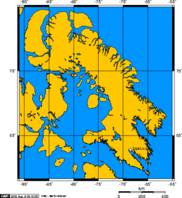
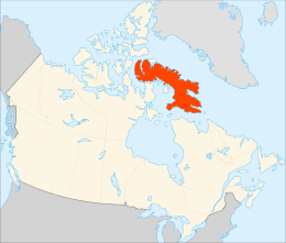
Baffin Island (Inuktitut: ᕿᑭᖅᑖᓗᒃ, Qikiqtaaluk IPA: [qikiqtaːluk], French: Île de Baffin or Terre de Baffin), in the Canadian territory of Nunavut, is the largest island in Canada and the fifth largest island in the world. Its area is 507,451 km2 (195,928 sq mi) and its population is about 11,000 (2007 estimate). It is located 65.4215 N and 70.9654 W. Named after English explorer William Baffin, it is likely that the island was known to Pre-Columbian Norse explorers from Greenland and Iceland and that it was the location of Helluland, spoken of in the Icelandic sagas (the Grœnlendinga saga and the Saga of Erik the Red, Eiríks saga rauða).
Iqaluit, the capital of Nunavut, is located on the southeastern coast. Until 1987, the town shared the name Frobisher Bay with the bay on which it is located.
To the south lies Hudson Strait, separating Baffin Island from mainland Quebec. South of the western end of the island is the Fury and Hecla Strait which separates the island from the Melville Peninsula on the mainland. To the east are Davis Strait and Baffin Bay, with Greenland beyond. The Foxe Basin, the Gulf of Boothia and Lancaster Sound separate Baffin Island from the rest of the archipelago to the west and north.
...
Wikipedia
